Location:
60 Queen Street West
NE corner of Queen & Bay
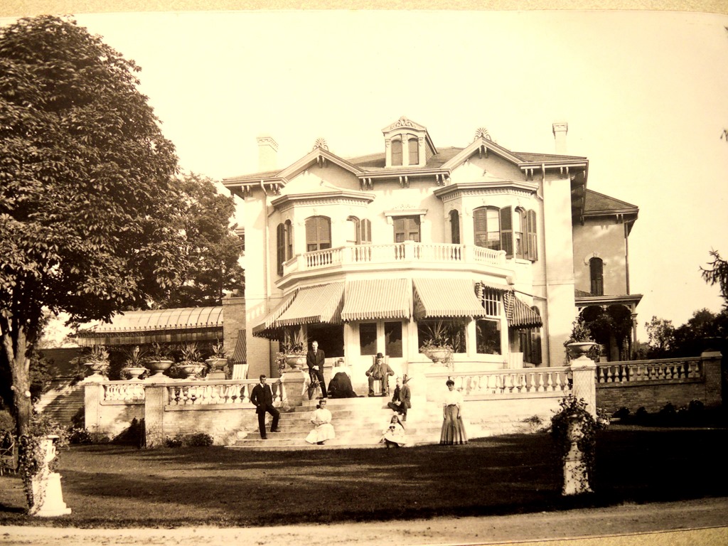
Now known as "Old City Hall", it was "New City Hall" when it was built. It now serves as a courthouse.
This was actually Toronto's 3rd city hall. The 1st was in the Market Block at St. Lawrence Market North, and the 2nd was in the New Market House (included on this map) at St. Lawrence Market South. The current (4th) city hall is across the street from Old City Hall, in Nathan Philips Square.
Artistic license included this building on the map years before it was completed in 1899. Though the tallest structure in Canada at the time, its size on the map is exaggerated for emphasis by the map's authors.
Location (former):
SW corner of Front & Parliament
The Upper Canada (now Ontario) parliament first convened at its former provinicial capital in Newark (now Niagara-on-the-Lake). In 1796, the capital moved here. The first dedicated parliament buildings, called the Palace of Parliament, were completed at this site in 1797. This was then the South-Eastern end of town.
At the time, John Graves Simcoe (lieutenant governor) selected York (now Toronto) as the new provincial capital to distance it from the US border. This move proved insufficient however, as the buildings were nonetheless destroyed during the War of 1812 with the US.
A new building was constructed on the same site in 1820, but it accidentally burned down in 1824. The 3rd and 4th parliament buildings (included on this map) were built in downtown and Queen's Park, respectively. The latter is still in use today.
Location (former):
N Front between John & Simcoe
Originally constructed as the 3rd Parliament of Upper Canada in 1832, this building became the 1st Ontario Parliament Building when Upper Canada (then Canada West) became Ontario at Confederation in 1867.
Then in 1893, the Ontario Legislative Building (included on this map) opened at Queen's Park, and this site was abandoned around the time of this map. The building was gradually demolished starting in 1900, and is now the site of Simcoe Place and the CBC.
Location:
111 Wellesley Street West
SW corner of Wellesley & Queen's Park
Though it had been a public park for decades prior, Queen's Park officially opened in 1860, making it one of the city's oldest parks. A former building at the park was occasionally used by the provincial parliament.
In 1893, the provincial government moved from the Ontario Parliament Building (included on this map) downtown to a new building at Queen's Park. The Ontario Legislative Building is the province's 4th parliament building. This building serves as the seat of parliament, housing the legislative assembly. It also contains the lieutenant governor's residence.
The building suffered some damage from a fire in 1909, and was restored and expanded. The Queen's Park grounds contain many monuments, memorials, and plaques documenting the province's history.
Location (former):
SW corner of King & Simcoe
In Canada, a "Government House" is the lieutenant governor's residence. Many in Ontario don't know this because Ontario no longer has one - but it had several!
The 1st was a small residence at Fort York, destroyed during the War of 1812. The 2nd was Elmsley House, destroyed by fire. The 3rd Government House was completed in 1870 on the site of the previous residence.
The house was abandoned in 1912 for a temporary residence at Cumberland House, followed by the 4th house at Chorley Park, that was demolished in 1961. The lieutenant governor now resides in a suite at the Ontario Legislative Building (included on this map).
The 3rd Government House was demolished in 1915, and the site is now home to Roy Thomson Hall.
Location:
250 Fort York Boulevard
SW corner of Front & Bathurst
The original fort was established by John Graves Simcoe (lieutenant governor) when the settlement now known as Toronto was called York, Ontario was the British province of Upper Canada, and Canada had not yet confederated. Fort York was built to defend the Toronto Harbour. At that time, prior to infilling of the harbour, the fort was on the lakeshore, and before the separation of the Toronto Islands, the harbour had only a single entrance to defend. The fort was destroyed during the War of 1812, and rebuilt by 1815.
In the 1840s, a new fort, later named Stanley Barracks (included on this map), was built to replace the aging old fort. However, the old Fort York continued to be used by the military until the 1930s, when it was converted to a museum and historic site.
Location:
2 Strachan Avenue
W Strachan N of lakeshore
Q: Why is Fort York sometimes called "Old Fort York"?
A: It's not just because it's old! It's because there is a New Fort York.
The new fort was built in 1841 to replace the aging old Fort York, and was renamed Stanley Barracks in 1893. Residents of the fort occasionally performed drills for exhibition audiences with whom they shared the grounds.
The new fort was demolished in the early 1950s to make more room for Exhibition Place (included on this map). The sole remaining structure is the Officers' Quarters, the largest of the fort's original buildings.
Fun fact: The "Stanley" who the fort was renamed after is the same Lord Frederick Stanley who gave the NHL the Stanley Cup.
Location (former):
361 University Avenue
SE corner of Armoury & University
The Toronto Armories were used for military training of both professional and volunteer regiments.
The building was included on this map ahead of its opening in 1894. It was demolished in 1963 to make way for the new Toronto Courthouse, and the facility was replaced by the Moss Park Armoury.
Location (former):
W Jarvis between Front & The Esplanade
This drill shed opened in 1877. It replaced a former shed on Simcoe Street, and was used for military training.
However, its life was short-lived; the shed was demolished in 1899 to make way for the new St. Lawrence Market South building currently on the site. The Toronto Armouries (included on this map) served its function thereafter.
Location:
999 Queen Street West
SW corner of Queen & Shaw
Q: What was CAMH before it was CAMH?
A: Trick question! It was always what it is today!
Originally named the Provincial Lunatic Asylum, the hospital opened in 1850. It was the largest public building in Canada at the time. The hospital was later renamed the Asylum for the Insane.
The facility was later renamed again, to Hospital for the Insane, Ontario Hospital, and finally the Queen Street Mental Health Centre, before the building was demolished in 1976. The site is now part of the Centre for Addiction and Mental Health (CAMH).
Location (former):
SW corner of King & Strachan
The Toronto Central Prison opened in 1873. This was the city's largest prison at the time. Inmates participated in various industrial activities, working to raise funds for the prison.
The premises no longer served as a prison after 1915, and the building was demolished in 1920, except for the prison chapel (included on this map). The site is now a residential area, and includes Liberty Village Park.
Location:
550 Gerrard Street East
NW corner of Gerrard & Broadview
The Don Jail (originally Don Gaol) opened in 1864. It included a farm (now Riverdale Park) worked by the inmates. While originally a progressive "reform" institution, it became overcrowded, leading to the addition of an East Wing, that also became overcrowded.
The jail closed in 1977. In 2013, the building was renovated and taken over by the adjascent hospital (included on this map).
Location (former):
1155 King Street West
SE corner of King & Fraser
The Andrew Mercer Reformatory for Women opened in 1880. It was unknowningly funded by Mercer after he died without leaving a will. The prison complex included separate facilities for a women's prison and a girls' refuge.
The institution was closed and demolished in 1969, and the site is now occupied by Lamport Stadium.
Location:
67 College Street
SE corner of College & Elizabeth
The Victoria Hospital for Sick Children opened in 1892. The hospital was involved with the development of several major contributions to medicine, including milk pasteurization, baby cereal (Pablum), X-ray imaging, and insulin.
The hospital moved out of the building in 1951 to the current facility on University Avenue, that is now known simply as The Hospital for Sick Children, or SickKids. The original building currently serves as a blood centre.
Location (former):
400 Gerrard Street East
NW corner of Gerrard & Sumach
What was originally York General Hospital, moved from the previous location downtown, to this new building in 1856. This was the 2nd Toronto General Hospital - Toronto's main hospital facility. A school for nurses was opened at the hospital in 1881 - Canada's second such school. The structure saw multiple additions and expansions over its tenure.
The hospital moved again in 1913, to its current site at the Discovery District. The old building was used by the military for a while, before being demolished in 1922.
Location (former):
65 Power Street
E Power between Queen & King
The House of Providence opened in 1857. It was run by a religious order called the Sisters of St. Joseph, known today for St. Michael's and St. Joseph's Hospitals, and St. Michael's College (included on this map), among others. The charitable institution served as a shelter, orphanage, and care facility.
In 1962, the House of Providence relocated to Scarborough, and the original property was demolished to make way for a Don Valley Parkway ramp.
Location:
30 The Queensway
NW corner of Lake Shore & Sunnyside
This was originally a house built around 1848 for John George Howard (city surveyor) and known as Sunnyside Villa. The Sisters of St. Joseph – a religious order – moved in in 1876 and set up an orphanage. They later purchased the property, and renamed it Sacred Heart, though it was often referred to as St. Joseph's Sunnyside Orphanage. The sisters greatly expanded the building.
The orphanage was converted to a hospital starting in 1921. The original Sunnyside building was demolished in 1945. St. Joseph's Hospital grew to absorb the neighbouring Our Lady of Mercy Hospital also run by the sisters. It later merged with other hospitals founded by the sisters - St. Michael's and the House of Providence (included on this map).
Fun fact: As Sunnyside Villa was one of the first prominent structures in the neighbourhood, the entire area eventually came to be known as Sunnyside. John Howard also owned the land to the West of Sunnyside, now known as High Park.
Location (former):
75 Church Street
NE corner of Adelaide & Church
This building was constructed for the Toronto Mechanics' Institute, and first opened in 1855. The institute had already been operating a library since 1831, and moved it here when they finally moved in in 1861. In 1884, the library was turned over to the city, and became the main branch of the Toronto Public Library. This was the first free reference public library in Canada.
The main branch moved to a new building in 1909 (now the Koffler Centre). This branch closed in 1927. The building was demolished in 1949, and the site is now condos.
Location:
110 Lombard Street
N Lombard between Church & Jarvis
The Central Fire Station was built in 1886. It was the city fire department's headquarters until 1910. The building's original spire was replaced with a bell tower (as shown in the photo) in 1895.
After it closed in 1970, the fire station building became known as "The Old Fire Hall". It is now a commercial property.
Fun fact: From 1973-1997, the hall hosted The Second City company theatre, a comedy troupe known in Canada for SCTV.
Location:
260 Adelaide Street East
N Adelaide between George & Frederick
This post office opened just as the Town of York changed its name to the City of Toronto in 1834 - it was briefly York's 4th General Post Office, and then Toronto's 1st. It served until 1839.
In the 1870s, the building was merged with its 2 adjacent neighbours. Since then, it has hosted various tenants.
The building was later restored, and reopened as the First Post Office Museum in 1983. It is Canada's oldest post office building, and functioning post office outlet.
Location:
10 Toronto Street
W Toronto between Adelaide & King
The 1st general post office building opened in 1815 when Toronto was still called York. The 2nd (1828-1830) and 3rd (1830-1833) were quickly outgrown by the expanding town. The 4th General Post Office (1834-1839) opened just before York renamed to Toronto. The 5th (1839-1845) was located where the historic Bank of Montreal (now Hockey Hall of Fame) building is today. The 6th (1845-1853) was also quickly outgrown.
The 7th General Post Office (now Toronto Street Post Office) opened in 1853, and served as a post office until 1873. It remained in government hands until 1937, after which time it was used by the Bank of Canada, and other financial institutions. It is 1 of only 2 of the city's general post office buildings that still stand today.
The 8th General Post Office (1874-1937) was the last such building in Toronto. 3 of the 8 buildings are indicated on this map (4th, 7th, 8th).
Fun fact: 10 Toronto Street was headquarters of Argus Corporation between 1959-2008, where media mogul and convicted felon Conrad Black was president.
Location (former):
38-42 Adelaide Street East
NE corner of Toronto & Adelaide
The post office was the dominant social media platform of its time, and growing at a rapid pace. The city's 7th Post Office was located just down the street (indicated on this map) in a small building that still stands today. In comparison, the 8th General Post Office was a major upgrade. It was completed in 1874, and expanded multiple times in its history. Post office boxes, and automobile delivery, among others, were pioneered in this building.
Some other government departments later shared the building. It was demolished in 1958, and replaced with the Mackenzie Building that remains there today.
Location (former):
SW corner of Front & Yonge
This was the city's 7th Customs House. It was built on the site of the previous customs house, and opened in 1876. The customs house handled import/export paperwork, customs, and duties, for goods shipped through the city's ports.
After narrowly escaping the Great Fire of 1904, the building was demolished in 1919. The Dominion Public Building that now occupies the site, took over its function as the city's next customs house.
Location:
N College between Spadina & University
The first post-secondary school in Upper Canada (now Ontario), King's College was founded in 1827 by John Strachan (bishop). Originally a religious institution, the college became secular in 1850, and renamed the University of Toronto.
Starting with University College (included on this map), the University of Toronto eventually federated with several other Toronto schools, including Knox College, Wycliffe College, Victoria University, St. Michael's College, and Trinity College (included on this map). It is now the largest university in Canada.
Location:
15 King's College Circle
S Hoskin between St. George & Queen's Park
Created in 1853, University College was the founding member college of the collegiate system of the University of Toronto. The building was completed in 1859. It suffered a major fire in 1890 and was restored.
The building was renovated in modern times. University College is now one of 11 colleges that constitute the university.
Location:
1 Spadina Crescent
Spadina between College & Willcocks
Knox College moved from its former home near Bay Street to this location in 1875. This was a theological college. It later became affiliated with the University of Toronto.
Knox College moved out of the building in 1914, at the beginning of WWI, after which it was used by the military. The college moved to its current premises on the University of Toronto campus. Today, the building is back in the hands of the university, and is now known as the Daniels Building. A significant renovation, restoration, and expansion was completed in 2017.
Location (moved):
N College between St. George & Queen's Park
This building, completed in 1855, replaced a wooden observatory on the same site. The (2nd) Toronto Magnetic and Meteorological Observatory was a government-run facility. It originally contained both a magnetic observatory and a meteorology service. A telescope for astronomical observations was added in 1881.
As nearby use of electricity and metal made magnetic measurements difficult in the growing city, the magnetic observatory moved to Agincourt in 1898. The meteorology service moved to a newer building on the North end of the University of Toronto campus in 1907, to reduce the impact of nearby construction. Instead of demolishing the now disused observatory, it was moved and rebuilt at its current location on campus in 1908, and renamed the Louis B. Stewart Observatory. It is currently used as a student administrative building. The observatory's former location is now part of the King's College Circle park ground.
Location:
149 College Street
S College between McCaul & University
Just prior to the time of this map, this site was host to Sleepy Hollow, the home of John Beverley Robinson (mayor, lieutenant governor). Robinson turned over his property to provide a site for construction. The Stewart Building was originally built for the Toronto Athletic Club in 1894, and included on this map ahead of its completion.
Robinson was club founder and president when the club moved into the building from their former office. The facilities included an indoor pool, gymnasium, and billiards room.
Robinson died 2 years after the move, and as a result, the club faced financial difficulties soon after. The building was sold off, and the club was closed in 1899. The Stewart Building has been renovated numerous times over its history. It is now used by the University of Toronto.
Location (former):
790 Queen Street West
N Queen between Crawford & Gore Vale
John Strachan (bishop) founded King's College, but against his objections, the publicly-funded school had secularized, and was renamed the University of Toronto. Strachan then founded Trinity College as a privately-funded religious alternative, that opened in 1852.
Though initially at odds with each other, the schools eventually merged in 1904. Trinity College moved to its current location on the University of Toronto campus in 1925. The original building was torn down in 1956, and the former campus is now Trinity Bellwoods Park.
Location (former):
NW corner of King & Simcoe
The Upper Canada College was founded by John Colborne (aka Lord Seaton) in 1829. The school moved from a temporary location in the Royal Grammar School at College Square to the Russell Square campus in 1831. The buildings were renovated and upgraded multiple times throughout its history.
In 1891, the college moved again, to its current location (included on this map) at Deer Park, so the Russell Square campus was already abandoned by the time of this map.
The campus lands were subdivided and sold off starting in 1902. They are now home to the Royal Alexandra and Princess of Wales Theatres.
Location:
200 Lonsdale Road
NE corner of Lonsdale & Forest Hill
In 1891, the Upper Canada College moved from its previous campus (included on this map) at Russell Square, to its current location at the Deer Park campus.
The building was replaced in 1959 by the current structure, that bears some resemblance to the original.
Location (former):
35 College Street
S College between Bay & Yonge
This was originally a mansion called Wickham Lodge, the residence of James Buchanan Macaulay (chief justice), built in the early 1840s. It was later renamed Wykeham Hall. In 1870, the Bishop Strachan School moved in from Bishop's Palace (included on this map) downtown, after making extensive renovations. This was a girls school.
The school moved to its current location at Forest Hill South in 1915. The structure was torn down in 1928 to make way for (Eaton's) College Park, that currently occupies the site.
Location:
N of lakeshore between Dufferin & Strachan
The Provincial Agricultural Fair moved from King & Shaw to the current exhibition site, along with the Crystal Palace (included on this map), in 1878. It then became the Toronto Industrial Exhibition. The Exhibition Place grounds gradually expanded over the years.
In 1912, the exhibition was renamed the Canadian National Exhibition (CNE), and became the world's largest annual fair. It eventually took over the grounds of the Stanley Barracks (included on this map) military site.
Aside from the annual exhibition - still the largest in Canada - the grounds now host year-round activities, particularly sports venues, concerts, and other events.
Location (former):
E Dufferin N of lakeshore
The original Palace of Industry building was modelled after the Crystal Palace in England, and built near King & Shaw Streets. In 1878, it was disassembled, moved, and partially reconstructed on the exhibition grounds, to become the 2nd Crystal Palace. This was the main building of the first Industrial Exhibition (later renamed the CNE).
The building was later renamed the Transportation Building, and was destroyed by fire in 1906. It was replaced by the Horticulture Building.
Location:
25 British Columbia Road
N of lakeshore between Dufferin & Strachan
The Scadding Cabin is the oldest surviving building in Toronto, and the only one from the 18th century on this map! It was originally built in 1794 for John Scadding, a clerk to the first lieutenant governor of Upper Canada (now Ontario). The Cabin was originally located East of the Don River.
In 1879, the cabin was donated to York Pioneers, the oldest historical society in the province. John is the father of Henry Scadding, clergyman of the Church of the Holy Trinity (included on this map), and owner of the Henry Scadding House (indicated on this map). Henry was also a well-regarded Toronto historian, and founder of the York Pioneers.
The York Pioneers moved the cabin to the Exhibition Place grounds for the event's inaugural year. The cabin remains there today, still operated by the York Pioneers as a museum.
Location:
1 Yukon Place
N of lakeshore between Dufferin & Strachan
French fur traders arrived in the Toronto area in the early 17th century. A small trading post called Fort Douville was built on the East side of the Humber River at Baby Point (included on this map) in the early 18th century, but was soon abandoned.
Another trading post called Fort Portneuf was built in 1750 near the mouth of the Humber River, and was so successful that an upgrade was soon needed. In 1751, a third and final post, Fort Rouillé, was constructed East of the mouth of the river, larger than its predecessor.
The new fort was also short-lived. In 1759, during the ensuing French Indian War, the French destroyed their own fort to prevent it from being captured by the British, and fled the region.
By the time the Exhibition Place (included on this map) grounds were established in 1878, the old Fort Rouillé's ruins were but a mound of earth, and a stone cairn was added to mark them. In 1887, the Fort Rouillé Monument was installed beside the cairn. Both the cairn and monument still stand today at Exhibition Place.
Fun fact: Both Fort Portneuf and Fort Rouillé were more commonly known as Fort Toronto, from which the city eventually inherited its name.
Location:
106 King Street East
NE corner of King & Church
The 1st St. James Church was built here in 1807. After its predecessor burned down in the Cathedral Fire of 1849, the Cathedral Church of St. James became the 4th church on this site. This Anglican church first opened for service in 1853.
However, the cathedral's hallmark spire was not constructed until 1874. This made it the tallest structure in Canada until 1899, when the clock tower on Old City Hall (included on this map) was completed. Nonetheless, its size on the map is exaggerated for emphasis by the map's authors.
Location:
57-65 Bond Street
NE corner of Shuter & Bond
St. Michael's Cathedral Basilica is a Roman Catholic church completed in 1848. It was built to accommodate the inflow of Irish immigrants that was already straining the pre-existing St. Paul's Basilica (included on this map). The congregation then quickly grew from the increased immigration that resulted from the Irish potato famine.
St. Michael's is one of the oldest surviving churches in the city, and the oldest Catholic church. The premises were the first home of St. Michael's College (included on this map) before it moved to its current location near the University of Toronto, and the first home of St. Michael's College School.
St. Michael's Cathedral was renovated multiple times in its early history, including the adjoining Bishop's Palace building, completion of the tower and spire in 1867, and addition of St. John's Chapel in 1891. It has also been restored in modern times.
Location (former):
17 Queen Street West
S Queen between Bay & Yonge
Knox Church was built in 1847, after the old church on the site was destroyed by fire. Knox Church was a Presbytarian church affiliated with Knox College (included on this map). The church was again severly damaged by fire in 1895, losing its steeple (as shown in the photo).
The building was later sold and abandoned, and subsequently demolished in 1906. The premises were taken over by the neighbouring Robert Simpson Company department store (now Hudson's Bay), that currently occupies the site. The congregation moved to its current location by the University of Toronto campus in 1909.
Fun fact: Knox Church still owns the land, and receives rent from Hudson's Bay.
Location:
56 Queen Street East
NW corner of Queen & Church
In 1872, the methodist church moved to this location from a smaller facility a couple of blocks South.
In 1925, a significant historical event occured in which several protestant denominations, including a number of churches on this map, merged to form the United Church of Canada. Consequently that year, the Metropolitan Wesleyan Methodist Church became Metropolitan United.
Much of the building, apart from the tower and spire, was badly damaged by fire in 1928 and rebuilt. The newly refurbished building also had Canada's largest pipe organ installed.
Location (former):
42 Elm Street
N Elm between Bay & Yonge
After the previous church was destroyed by fire, the Elm Street Methodist Church was erected on the same site in 1862. Its popularity lead to it being enlarged in 1877 to the form seen in the photo.
The congregation was merged with the Metropolitan Methodist Church (included on this map) in 1922. The church was demolished around 1954. Its former premises are now part of the Minto Plaza.
Location:
72 Beverly Street
NW corner of Beverley and Sullivan
There are several surviving 19th-century baptist church buildings on this map, including the Jarvis, College, Walmer, Ossington, and Beverley Street Baptist Church. These churches were all offshoots of the original Bond Street Baptist Church, on the site of present-day St. Michael's Hospital (included on this map).
The Beverly Street church opened in 1886. The area later became part of Chinatown. By 1972, the church was taken over by Chinese worshippers, and renamed the Toronto Chinese Baptist Church.
Location:
88 College Street
NW corner of College & Elizabeth
The congregation moved from downtown into this Zion Congregational Church in 1883. The congregation disbanded in 1910, and the church amalgamated with the United Church in 1925. The church building is now the University of Toronto Joint Centre for Bioethics.
Location (former):
162 Elm Street
NW corner of Elm & Simcoe
The Erskine Presbyterian Church was built in 1878. It was rebuilt in 1884 after a fire destroyed much of the original buliding.
The church was later renamed Church of the Christian Brotherhood. The premises were vacated in 1948, and demolished to make way for the Toronto Rehabilitation Institute of Mount Sinai Hospital that currently occupies the site.
The congregation eventually moved to Willowdale, but was closed soon after due to declining membership.
Location:
161 Spadina Avenue
E Spadina between Queen & Richmond
This was St. Margaret's Anglican Church. This short-lived church opened in 1890, and closed around 1909.
The building was converted to a factory in 1911, and is now used as retail space.
Location:
425 King Street East
SW corner of King & Trinity
Opened in 1844, the Little Trinity Anglican Church is the oldest surviving church building in Toronto. It was built as a lower-cost alternative to the other Anglican church in town - St. James Cathedral (included on this map) - and serviced many local factory workers. Over the years, a rectory was added, the church was enlarged, and it was damaged by fire and restored.
Location (former):
137 Richmond Street West
S Richmond between Simcoe & York
The Church of the Ascension was built in 1877, as a "competitor" to nearby St. George Church (included on this map). A separate building behind the church housed a Sunday school.
The declining congregation moved out of the church in the 1920s to a nearby facility, and the building was later rented out. It was finally sold and demolished around 1933. The site now contains the Hilton Hotel.
Location (former):
2-8 Front Street East
NE corner of Front & Yonge
The Toronto Board of Trade Building was completed in 1892, and served as the organization's headquarters.
The Board of Trade moved out of the building in 1914, and it was later taken over by the TTC. The building was demolished in 1958, after which it became a parking lot. Today, the site is occupied by an office building.
Location:
130 Queen Street West
NE corner of Queen & University
Osgoode Hall was completed in 1832 - when Toronto was still called York! It originally served as the home of the Law Society of Upper Canada (now Ontario), the regulatory body of lawyers in the province.
The building was expanded and refurbished multiple times throughout its long history. It was briefly used as a military barracks. Starting in 1846, it has been used to house the province's Superior Court of Justice. A law school was later established at the hall as well, that effectively got its name from the building: Osgoode Hall Law School. This was the province's only law school at the time.
The law school moved out of the building to the York University campus in 1968. However, Osgoode Hall remains the home of the Law Society to this day, and still hosts the Superior Court and the Ontario Court of Appeals.
Location (former):
89 Wellesley Street West
S Wellesley between Queen's Park & Bay
The Sisters of St. Joseph – a religious order – moved from Corktown into these premises in 1863. St. Joseph's Convent was both a school and a chapel, and served as the motherhouse for the sisters. The facilities expanded over the years to the form shown in the photo.
The college moved to its current location across the street in 1927. The convent moved to Willowdale in 1960 as the sisters' new motherhouse. The building was demolished shortly thereafter. The location is now Ontario Ministry buildings.
Location (former):
403-417 Wellington Street West
S Wellington between Portland & Spadina
This building started out as a mansion, originally built for Robert Sympson Jameson (attorney general) in 1837. The estate was later renamed Lyndhurst and expanded in the 1850s. Then the Loreto Sisters – a religious order – further expanded the former mansion and moved in in 1868. It was renamed the Loretto Abbey, and served as a girls school.
The sisters moved out in 1928 to their current home in Hogg's Hollow. The building then became a seminary until it was demolished in 1961. The location is now part of the Wellington Place residential neighbourhood.
Location:
10 Niagara Street
SW corner of Wellington & Portland
Victoria Square was Toronto's first cemetery. It was established along with Fort York (included on this map) as a military burial ground, and first opened in 1794. A number of victims of the War of 1812 were buried here. The cemetery closed in 1863, and largely neglected. In the mid-1880s, the square was converted to a park to help preserve it.
A War of 1812 memorial was added to the park in 1902 (as shown in the photo). The park has been renovated in modern times, and is now known as Victoria Memorial Square. A few surviving gravestones still stand.
Location:
375 Mount Pleasant Road
S Merton between Yonge & Bayview
Mount Pleasant Cemetery is a non-denominational burying ground. Although it opened in 1876, it contains many graves that were moved from the much earlier Potter's Field cemetery that closed in 1855.
At over 200 acres, Mount Pleasant is by far the largest cemetery on this map. Mt. Pleasant Road is named after it, and the Toronto Belt Line passes through it. Originally located on the outskirts of the city, it is now in the city center. The cemetery is part of the Mount Pleasant Group of cemeteries that includes the Toronto Necropolis (included on this map).
Location:
311 Pape Avenue
SE corner of Gerrard & Pape
Established in 1849, the Toronto Hebrew Congregation was the first Jewish institution in Toronto. The congregation founded the Pape Avenue Cemetery in the same year to serve the fledgling community. The congregation became Holy Blossom in 1856.
The cemetery closed in the 1930s, and can only by visited by appointment now. Holy Blossom continues to run it today.
Built in 1882, the Government Breakwater stretched near where Cherry Street is today, from the Keating Channel (in planning stages at the time of this map) to Fisherman's Island (now Cherry Beach). This was one of the first steps toward the creation of the Port Lands that replaced Ashbridge Marsh.
The breakwater was infilled during the development of the Port Lands in the late 1920s. However, it was recently unearthed during excavations for a restoration project, as shown in the photo.
The Toronto Carrying-Place Trail was a trade route that ran along the East side of the Humber River. It connected Lake Ontario to Lake Simcoe over land. Used by the indigenous Wendat (aka Huron) people in the 14th and 15th centuries, it was likely established much earlier.
French fur traders used the trail extensively for trade with the indigenous peoples starting in the 17th century. However, people and goods were not the only things to travel down the trail.
The trail led to the Mnjikaning Fish Weirs, called tkaronto by the Mohawk. The French accordingly referred to the Carrying-Place Trail as Passage de Taronto, and the Humber was called Rivière Taronto. This eventually led to the two French trading posts established near the mouth of the river being named Fort Toronto (aka Fort Portneuf and Fort Rouillé, see monument included on this map).
In 1834, the Town of York was renamed Toronto, a name inherited from the way tkaronto travelled down the trail.
There used to be a ravine here called Garrison Creek. Parts of the ravine were rich in mineral deposits, around which industry formed. By 1884, the creek was heavily polluted, and the city had decided to convert it into a brick storm sewer. The ravine was gradually infilled, and the creek was buried accordingly, including several bridges. Although it disappeared completely underground in the mid-20th century, at the time of this map, much of Garrison Creek was still above ground and visible.
Despite this, the creek is not indicated on this map, but its main course can be traced, as is the case today, by following adjascent geographical features. The Christie Pits (included on this map) were originally a sand and gravel quarry along the ravine. From there, the creek headed South to this location (now Bickford Park), that was a mine of clay for brick. From here, the creek swept West towards a region near Ossington (now Fred Hamilton Playground) that appears conspicuously empty on the map. It then curves back into the Trinity College (included on this map) campus (now Trinity Bellwoods Park). There is a large depression there today (known as the "dog bowl") marking the creek's former path. From there, the course of the stream can be inferred from the parallel curves of Walnut and Niagara Streets that interrupt the street grid system. Stanley Park is there today. The river then swept past the East side of Fort York (included on this map) and Garrison Common, for which the waterway was named. When the fort was established, Garrison Creek made a natural defensive palisade structure. The curve of Bathurst Street just ahead of the lakeshore is the final sign of the former creek visible on this map, before it drained into the lake beside Queen's Wharf.
Location:
N Bloor between Shaw & Christie
This is a part of the former Garrison Creek ravine that featured rich sand deposits. At the time of this map, this location hosted a sand and gravel quarry called the Christie Sand Pits.
By 1909, the quarry was exhausted, and the pit left behind was converted into Willowvale Park. This park was popular for swimming, tobogganing, skating, and baseball. In 1933, it was host to the Christie Pits Riot - the largest race riot in Canadian history - that started during a baseball game.
Today, the park's official name has reverted back to Christie Pits Park. This is inherited from the Christie Sand Pits, which in turn were named after the adjascent Christie Street. The street was named after a former land owner's wife, Christy McDougall (contrary to myth, this was long before William Christie, aka "Mr. Christie" cookies, had immigrated to Toronto, let alone set up his bakery).
Location:
N The Queensway between Ellis & Parkside
This was originally the estate of John George Howard (city surveyor). Howard and his wife deeded their property to the city on condition that it be designated a public park, called High Park. The city accepted, and the park opened to the public in 1876.
At the time, the park was on the remote edge of town, with access limited to boat and rail. The city added public access roads soon after the park opened. Additional properties were purchased and added to the park grounds over time, such that less than half of the modern park was originally from the Howards. This large park close to the city center contains many amenities, facilities, and other points of interest.
Location:
160 Gerrard Street East
N Gerrard between Jarvis & Sherbourne
George William Allan (mayor) gifted land to the Toronto Horticultural Society on condition that it be maintained as a public garden. Allan was president of the society at the time. Opened to the public in 1860, Allan Gardens is one of the oldest parks in the city. The gardens initially contained an open-air pavilion that was replaced in 1879 by an enclosed horticultural pavilion.
The enclosed pavilion burned down in 1902, and was replaced with the current Palm House in 1910. There was also a fountain in front of the pavilion that survived the fire but has since been removed. The new conservatory was expanded multiple times, as were the garden grounds.
Location:
N Front between George & Berkeley
The Toronto area lands (York County and York Region) were sold to the British in 1787, as part of the Toronto Purchase agreement. The province of Upper Canada (now Ontario) was established in 1791. In 1793, John Graves Simcoe (lieutenant governor) founded the original Town of York. The province's capital then moved from Newark (now Niagara-on-the-Lake) to York in 1796.
The settlement originally constituted 10 blocks between Adelaide & George, and Front & Berkeley streets. This initial grid was shortly extended in each direction. However, the town's centre eventually moved Northwest to Queen & Yonge streets.
The town greatly expanded over time. It was renamed the City of Toronto in 1834. The original blocks are now part of Old Town.
Location (former):
N Queen between University & Yonge
James Macaulay (Chief Medical Officer, Justice of the Peace) began dividing up his lot for houses around 1820. In his honour, the neighbourhood was named Macaulaytown. When York was incorporated into Toronto in 1834, the town was absorbed and renamed St. John's Ward.
Inexpensive housing led to many waves of immigrants settling here. The neighbourhood became a slum, and referred to simply as The Ward. The Ward was a first stop for many immigrants into the city, until they established themselves and moved out. Waves of immigration included black fugitive slaves, Irish famine exodus, Europeans fleeing revolutions, Jewish anti-semitism survivors, Italians escaping depression, and Chinese workers. It was the city's first Jewish quarter, Little Italy, and Chinatown, before they moved elsewhere.
Between the 1920s and the 1950s, The Ward was slowly expropriated and demolished. The area now contains the Discovery District, City Hall, Eaton Centre, and College Park.
Location:
S College between Bathurst & Spadina
Early Jewish immigrants to Toronto were spread around the town like everyone else. By the late 19th century, a slum district called The Ward was a common destination for new immigrants to the city, including Jews. However, by the early 20th century, established immigrants were moving out of The Ward and into more specialized districts such as Chinatown and Little Italy. Many Jewish immigrants moved to Kensington.
The Kensington neighbourhood was developed starting around 1854, when the former Denison estate was subdivided. Many row houses were added in the late 19th century that still stand today. In the 20th century, some of the new Jewish residents began opening storefronts to their homes. Soon, the area became known as the Jewish Market.
By the mid-20th century, the Jewish population moved out of Kensington, and settled North along Bathurst Street. No longer a Jewish district, the area instead came to be known as Kensington Market. Following a recent revitalization, the neighbourhood has become a popular tourist attraction today.
Location:
S St. Marks between Humber River & Jane
From about the 14th and 15th centuries, the (Iroquoian-speaking) Huron-Wendat Nation built multiple villages in the Toronto area. During the Beaver Wars in the mid-17th century, the Haudenosaunee, a confederacy from South of the lake, invaded the region. Armed by the British, they displaced and devastated the Huron-Wendat.
At this location, on a bluff overlooking the ancient Carrying-Place Trail by the Humber River, a village called Teiaiagon was then established. The village was jointly occupied by Seneca and Mohawk, 2 of the Haudenosaunee (aka Iroquois or Five Nation) confederacy's member nations. The village was 1 of only 2 Haudenosaunee settlements in Toronto (the other was in Rouge Park, in Scaraborough) - they were used to secure fur trading routes.
By 1700, less than half a century after their invasion, the Haudenosaunee were in turn displaced by the (Ojibwe-speaking) Mississaugas of the Anishinaabe, and had abandoned the village. During the early 18th century, Fort Douville (Magasin Royal), the first French trading post in the area, was located here.
The Mississaugas sold the Toronto area lands to the British in 1787, as part of the Toronto Purchase agreement. James Baby (inspector general) purchased this site in 1816, and built a cottage (shown in the photo) on the estate. The Baby family owned the site until 1910, after which its new owner developed Baby Point into a residential neighbourhood.
Location (former):
S Front between Princess & Trinity
The Consumers' Gas Company was Toronto's oldest public utility. In 1879, it purchased this property to expand its production of gas from coal, for heating, appliances, and industrial uses. Occupying over two and a half city blocks, the massive "Station A" complex can be seen on the top-left quadrant of the photo, including several round gas holding tanks.
After natural gas became available in the city in the 1950s, operations at Station A were halted. The property was sold in 1964 and demolished, except for 3 buildings (included on this map) on its West side.
Location (former):
SE corner of The Esplanade & Scott
The Toronto Electric Light Company (TELCO) was the first electric company in Toronto. This coal-based substation was built in 1887. The company got a big boost in the early 1890s when the Toronto Railway Company converted its streetcar service to electric.
The plant became obsolete after the city switched from coal to hydro-electric power in the early 1900s. It was partially demolished around 1926 as part of the waterfront development - the surrounding area, including the wharf the plant was built on was infilled. The rest of the site remained derelict until it was converted to a parking lot in the late 1950s. It is now occupied by the new railway viaduct and Gardiner Expressway.
TELCO was taken over by the provincial hydro-electric company, Hydro-Electric Power Commission (now Ontario Hydro).
Fun fact: TELCO was owned by Henry Pellatt, known for building Casa Loma. This company was one of several investments that made his fortune.
Location:
157 King Street East
SW corner of King & Jarvis
Following the Cathedral Fire of 1849 that devastated the area, there was room to build anew here. In addition to St. Lawrence Market North (included on this map), St. Lawrence Hall was completed in 1851. The Market Block (now St. Lawrence Market) was the social hub of the city, and this hall was built as a major venue for meetings, performances, exhibitions, and the market itself.
The hall went into a slow decline in the 20th century due to competition from newer venues. It gradually fell into disrepair to the point of partial collapse. The hall was then restored in 1967, and continues to be used for its original purpose.
Location:
92 Front Street East
NW corner of Front & Jarvis
Market Block, the city's oldest public market, opened on this site in 1803. A later market building here was damaged by the Cathedral Fire of 1849. In 1851, the 3rd incarnation of the St. Lawrence Market North building on this site was completed.
Along with the New Market House (now St. Lawrence Market South) and St. Lawrence Hall (included on this map), the 3 adjascent sites make up St. Lawrence Market.
The North building was again demolished in 1904 to make way for the next version. Currently, St. Lawrence Market North is in its 6th iteration, and still operating as a world-class public food market over 200 years after its establishment.
Location:
91 Front Street East
SW corner of Front & Jarvis
Toronto's 2nd city hall opened at the New Market House building in 1845, replacing the temporary assembly hall in the Market Block at what became St. Lawrence Market North. The building also housed a police station, jail, and shops.
City hall moved again to its 3rd location that is now known as "Old City Hall" (included on this map) in 1899. The former premises were then renovated and expanded to what is now St. Lawrence Market South in 1902. This structure saw additional renovations in the 1970s, but the facade of the original building can still be seen in the exterior of the current market building today.
Location:
S Mill between Parliament & Cherry
Gooderham & Worts established their business here in 1832. This was originally a grain mill, but soon expanded into a brewery, that became the company's primary focus. The business grew rapidly into a massive distillery complex that was the largest of its kind in Canada, and included the tallest chimney in the city.
In the early 20th century, the temperance movement adversely affected sales. The company was sold in 1923, and became part of Hiram Walker (now Pernod Ricard). The plant was closed by 1990.
The site is now the Distillery District, a pedestrian-only commercial district and historic site. It boasts North America's largest collection of Victorian-era architecture.
Location (former):
SE corner of Mill & Parliament
Built in the late 1880s, this Gooderham & Worts Grain Elevator replaced an earlier smaller wooden elevator in an adjacent site. At 8 stories tall, it was used to automatically unload and store massive volumes of grain for whisky production, from ships and rail cars, virtually eliminating manual labour.
The elevator was demolished around 1927 during the infilling of the harbour for the new raised railway viaduct that is currently at the location.
Location:
49 Wellington Street East
SW corner of Wellington & Church
The flatiron Gooderham Building replaced the earlier Coffin Block in 1892. It is unclear which of these buildings is depicted on this map - the Gooderham Building is taller and features a prominent cupola not shown on the map. The Gooderham Building served as the head office of Gooderham & Worts - founders of the Distillery District (included on this map).
The company headquarters moved from the distillery district to this building when it was built, and then moved back to the district in 1924, shortly after the company was sold. The building remained an office of Gooderham & Worts until 1952, and was sold a few years later. It has undergone some renovations since then, and continues to be used as an office building today.
Fun fact: The building is sometimes called the "Flatiron" due to its resemblance to the Flatiron Building in New York City. However, the building in Toronto is older by 10 years!
Location (former):
272-284 Simcoe Street
NW corner of Dundas & Simcoe
This was originally the William Street Brewery, built around 1862 for John Aldwell. It was renamed the Toronto Brewing and Malting Co. by its new owners in 1874.
The company was later bought out multiple times, eventually by Canadian Breweries aka Carling O'Keefe, now part of Molson Coors. The plant continued to host a brewery throughout the consolidations, until it was finally torn down in the early 1970s. It is currently home to One Park Lane condominiums.
Location (former):
521 Front Street East
E Bayview between Front & Mill
One of Toronto's enduring nicknames is "Hogtown", largely attributed to the city's pork packing industry. The William Davies Company moved from their previous location at the Toronto Packing House (included on this map) into their new pork processing plant in 1879. This was the largest such facility in the British Empire, and the second largest on the continent at the time.
Toronto's meat industry also included the Western Cattle Market (included on this map), and later, the Toronto Abattoir and Stockyards.
The company was eventually merged into Canada Packers, who took over the site in 1927, and later into Maple Leaf Foods. Operations moved to the Stockyards by 1932, and the plant's facilities were gradually demolished over several decades. It is now the site of Corktown Common park.
Fun fact: William Davies is credited with introducing peamail bacon to Canada.
Location (former):
SW corner of Wellington & Walnut
The Western Cattle Market opened in 1877. It replaced similar facilities in the East side of the city. Over the years, the industry expanded across the railway, a bridge (shown in the photo) was built to connect the sites, several abattoirs were constructed in the area, and also garbage incinerators.
The cattle market closed in 1913, before construction began on the Wellington Destructor incinerator (now derelict) on the site. By then, the industry had moved to the Stockyards at The Junction. The bridge is now replaced by the Garrison Crossing.
Location (former):
SW corner of Queen & Woodbine
The Woodbine Race Course first opened in 1874. This was a horse racing track. In 1881, the track's owner helpd found the Ontario Jockey Club (now Woodbine Entertainment Group), at one point the largest horse racing operation in the province, holding all 3 races of the Canadian Triple Crown across its various tracks.
The current Woodbine Racetrack in Etobicoke was opened in 1956. The old race course was renovated and renamed Greenwood Raceway in 1963. It was finally closed down and demolished in 1994. The track was converted to Woodbine Park, and the facilities later replaced with Champions Greenwood - an off-track betting venue.
Location (former):
W Broadview between Queen & Eastern
Originally called Toronto Baseball Ground, this was Toronto's first baseball stadium. It hosted the Toronto Baseball Club - also known as the Toronto Canucks, or just the Torontos - an International League baseball team. The team won the championship pennant in 1887 at the park.
The field was renamed Sunlight Park after the Sunlight Soap Works factory was built across the street. In 1896, the club left the stadium for the new Hanlan's Point Stadium on the Toronto Islands, and the team was later renamed the Toronto Maple Leafs. The park hosted various other local leagues until it was closed in 1913. The area is now built up with condos and highway, but Sunlight Park Road and Baseball Place mark the former site.
Location (former):
W York S of lakeshore
The Toronto Argonauts are better known today as a football team. However, the club started out (and is still today!) a rowing club. The Argonaut Rowing Clubhouse moved here from a smaller clubhouse in St. Lawrence Ward, but then it burned down, and was rebuilt in 1880.
Neighbouring docks hosted other aquatic clubs, including the Royal Canadian Yacht Club (included on this map), Toronto Canoe Club, and Queen City Yacht Club. Dredging in the area for eventual infilling of the harbour forced all the clubhouses to move elsewhere. The Argonauts were the last to move - to Parkdale - in 1921. The clubhouse was demolished soon after. The location is now an office building.
Location (former):
E Simcoe S of lakeshore
The Royal Canadian Yacht Club built their first clubhouse here in 1869. In 1881, the club moved to their current location at the Toronto Islands. However, some members of the group stayed behind, retaining the club's original name (Toronto Yacht Club) and clubhouse. The 2 clubs ended up amalgamating in 1889, and the old clubhouse continued to be used as a landing site for some time.
The original building was replaced in 1897, with the form shown in the photo. Dredging in the area for eventual infilling of the harbour forced the clubhouse to be abandoned. The building remained derelict for several years before being demolished around 1923.
Location (former):
11 Adelaide Street West
S Adelaide between Bay & Yonge
The Grand Opera House was Toronto's premier concert hall when it first opened in 1874. It featured steam-heating, electric gaslights, folding seats, and a gas-lit chandelier. The building suffered a major fire in 1879.
After decades of success, competing theatres and a highly publicized scandal spelled the end for the venue. The building was demolished in 1927. The location is now part of Scotia Plaza - a tiny alley named Grand Opera Lane remains.
Location (former):
131 Front Street West
S Front between Simcoe & York
A cyclorama was an interactive art exhibit space that showcased an immersive 360-degree panoramic image. The 16-sided Toronto Cyclorama first opened in 1887. The popular attraction featured props, special effects, and even live actors, for a more immersive experience.
The short-lived attraction was closed by 1900, shortly after the city's first movie theatres appeared. The building was then used as a showroom (as shown in the photo), and later converted to a parking garage. It was torn down in 1976 to make way for University Place (now Citigroup Place) that currently occupies the site.
Location (former):
7 Station Street
N The Esplanade between Simcoe & York
This was Toronto's 2nd Union Station, replacing wooden structures on the same site in 1873. The railway station was the largest and busiest in Canada.
Construction of a new Union Station to handle growing demand began in 1915. In 1927, the station moved one block East to its current location, and the old station was demolished.
The brick building with the tower (included on this map) that can be seen in the background on the right side of the photo, was added in 1895, and contained an arched entrance to the station.
Location (former):
NW corner of The Esplanade & Jarvis
The Northern Railway opened its City Hall Station in 1867, next door to city hall at New Market House (included on this map). Northern Railway was later taken over by the Grand Trunk Railway in 1888.
Following the acquisition, the railway station was closed in 1893, and railway passenger traffic was rerouted through Union Station (included on this map). The station was demolished in 1899 to make way for the new St. Lawrence Market South building currently on the site.
Location (former):
S Front between John & Simcoe
This railway yard on the Railway Lands, was built on infilled land (formerly water) starting in 1857. At the time of this map, Toronto's railways were dominated by the Grand Trunk Railway, and the Canadian Pacific Railway companies, who shared the Railway Lands, and this yard. The harbour to the South was later further infilled, and the Railway Lands, including this yard, were greatly expanded in the early 20th century.
The vast Railway Lands were gradually disused and dismantled starting in the 1960s. This yard was last used by the railway in 1986. It is now home to the CN Tower, Ripley's Aquarium, and Roundhouse Park. The park contains a reconstructed locomotive roundhouse from 1931 (itself replacing an older roundhouse from 1897) that now hosts the Toronto Railway Museum.
Location (former):
E Dufferin between Queen & King
This railway yard was constructed around 1879 for the Credit Valley Railway. Parkdale Yard was built next to the company's first station in Toronto, Parkdale Station. The yard included a roundhouse (shown in the photo).
There were several competing railways in Toronto at the time. Credit Valley Railway was taken over by Canadian Pacific Railway in 1884. After multiple other consolidations, Canadian Pacific Railway became 1 of only 2 major railway companies (along with the Grand Trunk Railway, now Canadian National Railway) serving the city at the time of this map.The Parkdale Yard became overloaded, and was moved to another yard starting in 1890, such that by the time of this map, it was already considered the "old" yard. The yard closed soon after and was demolished. It was then expanded and repurposed by 1910 with a completely different layout, and a new station. It went through several more rounds of repurposing before finally shutting down in 1990. The location is now mostly residential.
Location (former):
S Front between Bathurst & Spadina
This railway yard was constructed starting in the early 1850s for the Ontario, Simcoe & Huron company, Toronto's first railway. The company later became Northern Railway. The machine and engine shop, located near the Northeast corner of the yard, is prominent in the photo.
Northern Railway was bought out in 1888 by the Grand Trunk Railway. After multiple other consolidations, Grand Trunk Railway became 1 of only 2 major railway companies (along with the Canadian Pacific Railway) serving the city at the time of this map. Grand Trunk Railway was in turn taken over by the Canadian National Railway in 1923.
In the early 20th century, the harbour to the South was infilled, and the Bathurst Yard was greatly expanded as part of the Railway Lands. It has since downsized significantly, but remains in use today.
Location (former):
NE corner of The Esplanade & Yonge
Constructed in 1866 as the Great Western Railway Station, it was converted to the Grand Trunk Railway Freight Depot in 1882, when the Great Western Railway was acquired by the Grand Trunk Railway. The station's former railway passenger traffic was instead handled by Union Station (included on this map).
The shed was later converted to a wholesale fruit market. The building burned down in 1952, and the site eventually became home to the O'Keefe Centre (now Meridian Hall).
The Toronto Belt Line was a commuter railway service that ran from 1892-1894. This map is dated from the very brief period in Toronto history during which the Belt Line was operational - look closely to see trains in action! This location is on the Don Loop, the larger of the Belt Line's 2 service routes.
The Toronto Belt Line Railway Company went bankrupt before service even began. The railway was then taken over by the Grand Trunk Railway, who ran it for 2 years before shutting down service, having never made a profit.
The Grand Trunk Railway also went bankrupt in 1923, and was taken over by the Canadian National Railway, who eventually came to own the Belt Line as well. Although several sections of the Belt Line were repurposed for other railway routes, much of the track remained abandoned for years. By the late 1980s, approximately 1/3 of the original Don Loop route had been sold to the city and was converted into the Beltline Trail.
Location (former):
SE corner of Front & Spadina
A locomotive roundhouse is used for servicing and storing locomotives. This Grand Trunk Railway - Domed Roundhouse (visible on the right side of the photo) was built on the Railway Lands in 1857. Fully enclosed roundhouses like this one are unusual.
The roundhouse was demolished some time later in the 1890s. The CNR Spadina Roundhouse was later built at the same location.
Fun fact: It turns out that this wasn't the only domed structure built here: The SkyDome (now Rogers Centre) opened in 1989, and currently occupies the site.
Location:
165 Front Street East
SE corner of Front & Frederick
This structure is the Frederick Street Stables, built in 1888.
The Toronto Street Railway, who originally owned the stables, was a horse-drawn streetcar service. It was taken over by the Toronto Railway Company in 1891. The new operator converted the horse-drawn service to electric trams, with the first electric car run launched from the Frederick stables in 1892.
By the time the conversion completed in 1894, the stables were made obsolete, and repurposed into an electric power plant, as shown in the photo. After central power utility became available in the early 20th century, the powerhouse generator was put into reserve, and eventually shut down, with the buildings converted to a warehouse. The former stables were later renovated, and are now home to the Young People's Theatre.
Location (former):
126-132 Front Street East
NW corner of Front & Frederick
This car shop was built for the Toronto Street Railway in 1882. The horse-drawn service was taken over by the Toronto Railway Company electric service in 1891. The shops were accordingly converted from building and storing horse-drawn streetcars to building and repair of electric trams. Most of the company's new streetcars were built here.
The streetcar service was taken over by the TTC in the 1920s. The shops were moved to the Hillcrest Complex in 1924, and the facilities were rented out, as shown in the photo. The building was demolished in 1979, and the site is now condos.
Location (former):
SW corner of Front & George
The George Street Stables were built for the Toronto Street Railway in 1881. The stables are the prominent long building on the bottom left of the photo.
The company owned several properties in this neighbourhood, such as the Car Shops (bottom right of the photo), Frederick Stables (included on this map), and George Stables. The Street Railway was the TTC of its time, using horse-drawn streetcars. In 1891, it was taken over by the Toronto Railway Company, who converted to electric trams around the time of this map. This service was in turn taken over by the TTC in the 1920s.
The stables burned down in 1902, after which the site was used as a storage yard. The location is now condos.
Location (former):
396 King Street West
NW corner of King & Peter
The Shedden Forwarding Company was a Montreal-based cartage service using horse-driven trucks. As automobiles replaced horses in the 1920s, Shedden eventually moved out of the stables, and they were demolished in the 1930s. The site of the former stables is now retail property.
Location (former):
257-259 The Esplanade
S The Esplanade between Princess & Parliament
Elias "King Coal" Rogers, owner of the country's leading coal supplier Elias Rogers Coal & Wood Co., had several properties in the city, including this wood and coal yard. The yard grounds were filled-in on former waterfront some time in the late 1880s, and can be seen on the right side of the photo, behind the smoke stack.
Wharves and docks along the waterfront, including this yard, were infilled around 1927 to make way for the new raised railway viaduct that currently occupies the site.
Fun fact: Elias Rogers was the great-uncle of Ted Rogers, who founded the Rogers Communications media empire.
Location (former):
S The Esplanade between Yonge & Scott
This wharf started beside a soap and candle factory in 1841. The Freeland Wharf moved in the 1850s as the lakeshore was infilled, and gradually expanded in the 1860s to eventually become the Yonge Street Wharf, seen in the right side of the photo. It served as a general merchandise and passenger steamship dock.
The waterfront area including the wharf was infilled around 1926. The site is now occupied by the new railway viaduct and Gardiner Expressway.
Location (moved):
W Bathurst S of lakeshore
In the 19th century, Toronto Harbour featured a single navigable entrance on its Western side. Queen's Wharf, situated by this channel, was equipped with a lighthouse (included on this map) in 1838. This lighthouse was replaced in 1861 by a pair of White and Red Lighthouses.
The narrow Western Channel proved insufficient for larger ships, and a wider channel was dug further South. Called the Western Gap, the new entrance had its own range lights that made the lighthouses obsolete. They were deactivated in 1911.
While the White Lighthouse was demolished, the Red Lighthouse was moved to a nearby site on Fleet Street in 1929, West of its original location. The Queen's Wharf Lighthouse was restored in 1988, and still stands there today.
Location (former):
S The Esplanade between Frederick & Sherbourne
Polson Iron Works was a major shipyard that started building ships in 1883. The yard later expanded, and was recruited for military manufacturing in World War I.
Global competition, silt in the harbour, and plans to infill the waterfront, eventually spelled the end for the company. Polson ceased operations following bankruptcy in 1919, and the yard was sold and abandoned.
Fun fact: Knapp's Roller Boat, an infamous failed design for a roller ship, was built at this shipyard in 1897. After its failed trials, it was moored near the yard, parts sold for scrap, and the rest buried, along with the shipyard, around 1927, when the area was infilled to make room for the new raised railway viaduct that currently occupies the site.
Bonus fact: The name survives today in Polson Street and Polson Pier, a complex in the Port Lands area of the Toronto Harbourfront.
Location (former):
S Front between Bathurst & Spadina
While a railroad wharf has existed here since the 1850s, it was not until 1890 that the John Doty Engine Works (included on this map) opened a shipyard at this location. The Doty Company had sold the shipyard by the time of this map. The Bathurst Street Wharf went on to host a variety of other shipyards until it was retired around 1917, when the waterfront area was infilled. A new wharf and shipyard were built further South, and remained in use until the end of WWII. The old wharf site is now Canoe Landing Park and associated facilities.
Location (former):
W York S of lakeshore
Henry Aykroyd moved his firm from Yonge Street to York Street in 1880. The company built small sailing boats. After his death, his sons continued the business as the Aykroyd Brothers Boat Works.
The business was forced to move in 1921 as the area was being infilled. They moved to Bathurst Street and continued operating until 1943. The boathouse was demolished soon after the move. The location is now an office building.
Location (former):
SW corner of King & Massey
The Massey Manufacturing Company was an agricultural equipment manufacturer producing some of the earliest farming automation machinery in the world. It moved from Newcastle to the Toronto Works plant in 1879.
This was a large factory complex, and many changes and additions were made to the plant as it sprawled over the years. The company merged into the Massey-Harris Company in 1891, becoming one of the largest manufacturers in its industry.
Massey-Harris later merged again, into Massey-Ferguson, and closed the plant in 1982. The buildings were demolished by 2003, except for the head office (included on this map). The rest of the site was converted into a residential area, and includes Massey-Harris Park.
Location (former):
25 Bathurst Street
NE corner of Front & Bathurst
In 1891, Doty's Machine and Engine Works moved from the Northwest corner of Front & Bathurst (included on this map) to the Northeast corner. The plant manufactured ship engines, and was the largest of its kind in Canada.
Financial trouble hit the company soon after the move, and it was taken over by its creditors by the time of this map. The works continued to build ship engines until 1907, after which the structure was used by other industries. The building was demolished in 2011, to be replaced by condos.
Location (former):
48 Abell Street
SW corner of Queen & Abell
In 1886, the John Abell Engine and Machine Works company moved from Woodbridge to this factory complex. The company manufactured primarily agriculture-related engines and machinery. At the time, the factory was the largest of its kind in Canada.
The company later merged into American-Abell Engine and Thresher Company, and again into The M. Rumely Company, who stopped building engines at the plant in 1914. Subsequently, the complex was used by a variety of manufacturers, and eventually converted into residential space. The buildings were demolished in 2007, to be replaced by condos.
Location (former):
14 Strachan Avenue
SW corner of Wellington & Strachan
In 1881, John Inglis and Sons moved from Guelph to this site. The company manufactured grist and flour mill machinery. The plant was rebuilt and expanded in the early 1900s, as shown in the photos.
The Inglis company later moved from milling machinery to ship engines, military weapons, consumer products, and household appliances. The complex was gradually demolished in the 2000s, and converted to residential space. The Inglis brand of household appliances is now part of Whirlpool Canada.
Location:
570 King Street West
N King between Portland & Brant
The Toronto Silver Plate Company was founded in 1882. It was the first in Canada to manufacture silver plated products.
The company was later bought out multiple times, and the name stopped being used. The factory went on to house multiple other businesses. The building was restored in 2014, and is now part of Fashion House.
Location:
200 King Street East
SW corner of Adelaide & Frederick
With the help of his then business partner, William Christie formed the biscuit bakery Christie, Brown & Company. Mr. Christie moved his factory to this location in 1874, growing it to become the largest in Canada. He then bought out his partner's share, to become the sole owner of the biscuit manufacturing company.
The plant eventually expanded to take up the entire city block. The company was later acquired by Nabisco, who kept the well-known "Mr. Christie" brand of cookies. The factory complex was eventually sold off, and is currently home to George Brown College's St. James campus.
Location:
53 Strachan Avenue
SE corner of Wellington & Strachan
The John B. Smith & Sons lumber company moved from Front & Bay (included on this map) to these premises in 1888. The complex included a planing mill building and a lumberyard.
John B. Smith was Toronto's lumber baron, and one of the largest lumber supliers in the country. It remained a family business throughout its history. The company ceased operations in 1967.
The planing mill building was renovated in 1996, and is now Strachan House. The former lumberyard is now the Southern half of Stanley Park.
Location (former):
9-43 Front Street West
SE corner of Front & Bay
The John B. Smith & Sons lumber company moved into these premises in 1865, a few years after a previous mill and yard on Niagara Street were razed by a fire. The buildings can be seen on the left side of the photo. However, by the time of this map, operations had moved again to Wellington & Strachan (included on this map). The company retained ownership of the property, and leased it out to various wholesale stores and warehouses.
The buildings were then destroyed in the Great Fire of 1904 that devastated the area. As of 1935, the site is home to the Dominion Public Building.
Location:
70 The Esplanade
NW corner of The Esplanade & Church
Greey's Mill Furnishing Works opened in 1882. This foundry manufactured machine parts for a variety of industries. By 1903, the factory complex was expanded multiple times, as shown in the photo. Today, the building serves as office space.
Location (former):
47-61 Hayter Street
SE corner of Hayter & Bay
This facility was built around 1872, and the Cobban Manufacturing Company moved in around 1881. The factory manufactured picture frames, glass products, cabinet work, and more.
Cobban moved again, to the lakeshore, shortly after this map was made, and became Phillips Manufacturing. The building hosted various other businesses until its demolition in the early 1950s. The entire East end of Hayter Street is now part of College Park.
Location:
500-522 King Street West
NE corner of King & Brant
The Gurney brothers ran a Hamilton-based stove manufacturing firm - the largest in Canada. They expanded their business by opening this factory in Toronto in 1872. The E. & C. Gurney Stove Foundry manufactured stoves and castings. The plant was expanded over the years, with the West wing being added in 1887.
Gurney later merged into Tappan Stoves, now part of Electrolux. The foundry was renovated in modern times, adding an above-ground passageway between the 2 remaining buildings. It is currently a commercial space.
Location:
190 Yonge Street
W Yonge between Dundas & Queen
Timothy Eaton moved his store from its original premises one block South, to its current location in 1883. The store pioneered set price (no-haggling), cash only (no-credit), and satisfaction guarantee (money-back) policies, allowing the company to grow rapidly. The T. Eaton Company expanded multiple times, to eventually occupy several city blocks, and become Canada's largest retailer.
The Eaton Main Store and later additions were replaced by the Toronto Eaton Centre in 1977. The complex eliminated several pre-existing streets, to become the largest shopping mall in the city. The company went bankrupt in 1999, but the well-known mall bearing its name remains operational today.
Fun fact: The Toronto downtown PATH network holds a Guinness World Record for the largest contiguous indoor shopping space. The oldest segment of the PATH was built in 1900, between the Eaton Main Store (now Toronto Eaton Centre) and the Eaton Annex building (now Trinity Square). It is still in use today.
Bonus fact: Canada's first escalator was installed at the Eaton Main Store in 1904.
Location (former):
136-140 King Street East
N King between Church & Jarvis
Thomas Thompson built the Mammoth House in 1847 to expand his retail business. The building had to be reconstructed just 2 years later, following the Cathedral Fire of 1849. Nonetheless, the business was quite successful, and passed on to his son, Thomas Thompson Jr.
T. Thompson & Son sold dry goods, such as clothing and footwear. This was an early department store in Toronto. The Mammoth House was one of several stores in the neighbourhood that used a large mascot statue of a creature on their storefront, such as the Golden Griffin, and Golden Lion (included on this map). The building was greatly expanded in the late 1880s into the prominent structure depicted on this map.
After decades of prosperity, the company moved out of the building by 1905, and closed shop altogether shortly after. The building was demolished around 1927, and the location is now part of St. James Park.
Location (former):
48-50 Front Street West
NW corner of Front & Bay
This warehouse was built for Gordon Mackay and Company in 1870. Gordon Mackay, originally from Hamilton, moved to Toronto in the 1850s, and were expanding. They were manufacturers and wholesalers of dry goods - primarily cotton clothing.
The building was destroyed by the Great Fire of 1904 that devastated the area. The company built a new warehouse on the same location that year, as shown in the photo. Gordon Mackay grew to a Canada-wide operation, and branched out to retail stores. The new warehouse was demolished in 1973 to make way for the Royal Bank Plaza that currently occupies the site.
Location (former):
50-54 King Street West
NW corner of King & Bay
The Mail Building replaced the former Toronto Mail newspaper headquarters at the same location in 1881. After a fire in 1884, it was topped with a spire and observation deck, making it the city's first skyscraper.
The Toronto Mail newspaper later merged into The Mail and Empire, which in turn merged into The Globe and Mail. The building was demolished in 1939 to be replaced with a Bank of Montreal building, and is now the site of the BMO headquarters at First Canadian Place.
Location:
20 Richmond Street East
NW corner of Richmond & Victoria
Billed as the largest and tallest office building in the city when it opened in 1893, the Confederation Life Building was the headquarters of the Confederation Life Insurance Company.
Confederation Life moved out of the building in 1955. The company is now dissolved following liquidation. The building was renovated and restored in the early 1980s, and is still in use as an office building today.
Location (former):
42-46 King Street West
N King between Bay & Yonge
The Canada Life Assurance Company building replaced a previous branch office at the same location. It was a skyscraper when it was completed in 1888.
The company moved to the new Canada Life Building location on University Avenue in 1931. The former headquarters was eventually demolished around 1946 to make way for The Bank of Nova Scotia Building, now in Scotia Plaza, that currently occupies the site.
Location:
252 Adelaide Street East
NE corner of Adelaide & George
The Bank of Upper Canada building was constructed in 1827 - when Toronto was still called York! It was the fledgeling town's first bank building. The bank occupied the premises until its collapse in 1866.
Several additions were made to the building over the years, including extensions in the back, a new roof, and a 3rd floor. In the 1870s, the building was merged with its 2 adjacent neighbours (shown in the photo), the De La Salle College, and 4th Post Office building (included on this map).
After a fire in 1978, the building was restored and reopened as commercial space. Along with its neighbours, the entire complex still stands today.
Location (former):
21-25 King Street West
SW corner of King & Jordan
The Canadian Bank of Commerce building was the bank's head office from 1887, and was an early skyscraper in the city.
The original building was demolished in 1928 to make way for the new Commerce Court North building. The company later merged into CIBC who still uses the new building as its corporate headquarters.
Location (former):
48 King Street West
NE corner of King & Bay
This was originally the Cawthra House, a mansion built for William Cawthra (city alderman), in 1853. In 1885, the building became a branch of Molsons Bank, a Montreal-based bank.
The bank moved out in 1907, and later merged into the Bank of Montreal. The building was demolished in 1946 to make way for The Bank of Nova Scotia Building, now in Scotia Plaza, that currently occupies the site.
Location:
30 Yonge Street
NW corner of Front & Yonge
The Bank of Montreal opened its new Ontario head office building in 1887. It replaced a previous branch on the same site. The building is notable for its opulence, including a domed ceiling, and stained glass skylight.
The Bank of Montreal moved its headquarters to First Canadian Place in 1977. This branch closed in 1982. Subsequently, the bank building was incorporated into BCE Place (now Brookfield Place). As of 1993, the building hosts the Hockey Hall of Fame.
Fun fact: Prior to the original Bank of Montreal branch that preceded the head office building, this site was the location of Toronto's 5th General Post Office building (1839-1845).
Location:
61-67 Yonge Street
NE corner of Yonge & Colborne
The Traders Bank of Canada building was completed in 1890. The bank moved its head office into it from the previous location down the street. The original building can be seen sticking out of the middle of the row of buildings on the right of the photo.
In 1905, the Traders Bank Building was replaced by a 15-storey skyscraper - the tallest in the British Empire at the time - that still stands today. Traders Bank was acquired by the Royal Bank of Canada in 1912.
Location (former):
21-23 Front Street East
SE corner of Front & Scott
This warehouse was originally built in the early 1870s for Frank Smith & Co. Wholesale Grocers. Eby, Blain & Co., also wholesale grocers, moved in in 1891, from their previous location across the street.
The building continued to be used as a wholesale grocery warehouse until it was demolished around 1967 to make room for the St. Lawrence Centre for the Arts, that currently stands on the site.
Location (former):
1 Bay Street
NE corner of The Esplanade & Bay
The Royal Dominion Flour Mills plant was built around 1866 for Henry John Boulton (attorney general). M. McLaughlin & Co. purchased the flour mill in 1876 and expanded it multiple times.
The building was destroyed by the Great Fire of 1904 that devastated the area. The location is now occupied by CIBC Square.
Location (former):
N Bloor W of Humber River
This was the site of York's (now Toronto) first sawmill - the King's Mill. A series of lumber, and later grist (grain), mills were built on this site. Several of them were destroyed by fire. The last of these was Gamble's Mill, built around 1850, on the location of the previously burned down mill. Alas, this mill too sucumbed to fire in 1881, and the site was finally abandoned.
The Old Mill ruins remained a landmark in the area. Later, a restaurant (now hotel) called The Old Mill was established on the site, as well as Old Mill Bridge, Old Mill Road and Old Mill Drive, and eventually the entire neighbourhood came to be called Old Mill. The ruins were finally demolished in 2000 to make way for the hotel.
Location (former):
265-283 King Street West
S King between John & Simcoe
The Dominion Saw & Lead Works was built in 1872 for the James Robertson Company. This company manufactured various products, such as saws and plumbing fixtures.
In 1913, the company moved to the Robertson Building on Spadina, and the factory was rented out to other tenants. The plant was demolished in the mid-1970s. The former site of the works is now part of Metro Hall.
Location (former):
800-820 King Street West
N King between Niagara & Tecumseth
This trunk and bag factory was built around 1874 for H. E. Clarke and Company. It was renamed the Langmuir Manufacturing Company in 1890. Langmuir specialized in luggage (travelling trunks and bags), and later became the largest trunk manufacturer in Canada. The plant underwent extensive restructuring and expansion at the end of the century.
The company closed down around 1960, and the factory was demolised. The location is now residential.
Location:
550 Bayview Avenue
N of Bloor W of Don River
The Taylor family owned nearby Todmorden Mills (included on this map), and accidentally discovered high quality clay on their property. The Don Valley Pressed Brick Company was then established in 1889. It quickly gained a reputation for producing prize-winning high-quality bricks. However, by 1901, the company was brankrupt. It was sold to a relative who renamed it the Don Valley Brick Works.
The new owner benefitted greatly from the construction spree that followed the Great Fire of 1904. The large complex was sold, renamed, renovated, and modified multiple times throughout its history.
Brick production finally ceased in 1989, and the plant closed shortly thereafter. Now a historic site and park, the oldest building that survives on the grounds dates back to 1891.
Fun fact: The Taylor family name lives on in Taylor-Massey Creek. Both the Taylors and the Masseys were wealthy families who owned large estates around the creek.
Location:
67 Pottery Road
N of Bloor E of Don River
A lumber mill was first set up here in 1795. The site later expanded to include grain mills, a brewery and distillery, and other buildings, and came to be known as Don Mills. In 1827, York Paper Mill was added to the complex - it was only the 2nd such mill in the province at the time. The Taylor family purchased the site in 1855, and renamed it Todmorden Mills. This was 1 of 3 mill complexes they owned along the Don River.
The operation was very successful under the Taylors. Machine-made paper and wood-pulp based paper making were pioneered here. The Taylors also went on to found the Don Valley Brick Works (included on this map).
The paper mill burned down in 1900, but was rebuilt, and ran until the 1920s. The site saw various uses since then, including a WWII prisoner of war camp. The mill complex was converted to a museum, opened in 1967, and restored. The former York Paper Mill, with its prominent chimney, is now The Papermill Theatre.
Location (former):
78-92 Front Street West
N Front between York & Bay
The 4 townhouses of Ontario Terraces were erected in 1838, and were an early host of Knox College. When the college moved out around 1855, the houses were merged and converted into a hotel. The hotel was later expanded and renovated, and renamed the Queen's Hotel in 1862. This was arguably the city's most luxurious hotel, hosting several prominent guests over its lifetime. The hotel greatly benefited from its proximity to Union Station (included on this map).
After narrowly escaping the Great Fire of 1904, the Queen's Hotel was demolished in 1927 to make way for the Royal York Hotel that currently occupies the site.
Location:
106 Broadview Avenue
NW corner of Queen & Broadview
The tallest building East of the Don River when it was built around 1892, Dingman's Hall was originally a commercial building. The hall included retail, office, meeting, and performance spaces.
In 1907, the hall was converted to a hotel, as shown in the photo. Now known as the Broadview Hotel, it has served in such capacity ever since.
Fun fact: For a period of its history, the building was a boarding house, with a strip club on the ground level, later known as the infamous Jilly's.
Location (former):
326-338 King Street West
NW corner of King & John
This hotel opened in 1889 as the Grand Pacific, and was later renamed Arlington Hotel.
Arlington briefly served as a veteran hostel after WWI. It closed in 1933, and was demolished by 1937. The site is now TIFF Lightbox.
Fun fact: The Arlington Hotel was built on the former site of Toronto's first hospital, York General Hospital (1829-1856), that later became Toronto General Hospital (included on this map).
Location:
187 King Street East
SE corner of King & George
This building opened as the Little York Hotel in 1880. The hotel's stables and coach house, built the same year at 65 George Street, abutting the Southern side of the inn, is also visible, though not prominent on this map.
The Little York Hotel served as an inn until the late 1920s. The stables were originally 1 storey; a 2nd storey was added recently, as seen in the photo. The buildings are now used for office space.
Fun fact: The Little York Hotel was built on the former site of Toronto's first public school, the Home District Grammar School (1807-1813), that eventually evolved into Jarvis Collegiate Institute (included on this map).
Location (former):
114-120 Front Street East
NE corner of Front & George
This was originally a mansion built around 1820 for George Monro (mayor). It was converted to a tavern in the early 1840s, and later renamed the Black Horse Hotel. The building was renovated a few times over its history.
The Black Horse was torn down in 1919. The location is now a condominium complex.
Location (former):
37-41 Jarvis Street
E Jarvis between King & Front
Established 1837, the Albion Hotel prided itself on its high-value offering. The hotel premises expanded and contracted over its history, and survived until around 1920. The building was demolished in the late 1930s, and the location is now condos.
Location:
197 King Street East
S King between George & Frederick
The Nealon House hotel was built in 1888. As the East side of the building was exposed for much of its history, it was often used for lavish painted wall advertisements, such as the Wrigley's Gum ad shown in the photo.
The building continued to serve as a hotel under different names, until around 1977.
Location (former):
121 Front Street West
SW corner of Front & York
The Walker House Hotel opened in 1873 - the same year as neighbouring Union Station. The hotel benefitted greatly from its proximity to the growing railway traffic, downtown commerce, and government buildings. It was expanded multiple times throughout its early history.
The Walker House survived until 1976, when it was demolished. It was replaced by the University Place (now Citigroup Place) office tower.
Location (former):
146-156 King Street West
NW corner of King & York
Although currently home to office towers, the intersection of King & York has a long history of hotels. Originally built as the Mansion House around 1871, this building became the Palmer House hotel in the mid-1880s. It ran until around 1915, after which the building was used as a commercial property, and became known as the York Building. This was not the last hotel on the site however, as the short-lived Lord Simcoe Hotel was built here in 1956. The Sun Life Financial Tower (now Sun Life Centre) currently stands on the site.
Location (former):
91 York Street
SE corner of King & York
The Rossin House Hotel originally opened in 1857. It was heavily damaged by fire in 1862, and restored and reopened by 1867. Rossin House was one of the city's most upscale hotels at the time.
The hotel was renamed the Prince George Hotel in 1909, and demolished in 1969. Now, the Standard Life Centre office tower occupies the site.
Location:
298 Queen Street West
NE corner of Queen & Soho
Originally built in the 1830s, the Black Bull Tavern was rebuilt in 1886 in its current form. It has been expanded and renovated multiple times since then. During much of the 20th century, the Black Bull was renamed Hotel Clifton (as shown in the photo), but has reverted since to its original name.
Location:
145 Front Street East
SW corner of Front & Frederick
This was originally the Toronto Packing House, built for the William Davies Company in 1868. William Davies later moved to a larger plant by the Don River (included on this map). The building was then taken over by J & J Taylor Manufacturers, who moved in from their previous plant in Corktown. J & J Taylor were makers of safes, and the factory became known as the Toronto Safe Works. The property was expanded multiple times over its history.
The Taylor Safe Company merged into Chubb Locks in 1960, and the Taylor name is no longer in use. The building continues to serve as a commercial property.
Location (former):
SW corner of The Esplanade & Jarvis
The Toronto Carpet Factory opened in 1892. The building can be seen in the middle of the photo near the bottom, on the North end of Beard's Wharf. This was a very successful manufacturer of carpets in Canada.
The company soon outgrew this factory and moved to its current location at King & Fraser in 1899. The original premises were demolished a few years later.
Location (former):
141-145 Front Street West
S Front between Simcoe & York
H.W. Petrie & Co. moved its manufacturing operations to this Machine Depot from Brantford in 1891. Petrie was a manufacturer and dealer of new and used machinery.
In the early 20th century, Petrie took over the neighbouring Cyclorama building (included on this map) and converted it into a showroom, and later a parking garage. The domed Cyclorama can be seen beside the depot building in the right side of the photo. The company also abandoned manufacturing to focus exclusively on machine sales, outsourcing manufacturing to others. Petrie moved out of the building in 1948, and it was demolised in 1976 to make way for University Place (now Citigroup Place) that currently occupies the site.
Location (former):
68-70 Front Street West
N Front between York & Bay
This building was constructed for Warwick & Sons around 1889. The company later changed their name to Warwick Brothers & Rutter. This was a wholesale printing company, specializing in stationary and postcards. They were at the forefront of colour printing in Canada, and were the Ontario Government printer.
The building was destroyed by the Great Fire of 1904 that devastated the area. The company built its new premises at King & Spadina. Their former location is now part of the Royal Bank Plaza.
Location:
85-97 King Street East
S King between Leader & Church
Victoria Row was a strip mall built in 1842. It was renovated multiple times over its history. Since 1898, it has also been home to the Albany Club - a private social club.
Only one segment of the original structure remains today - it can be seen in the middle of the photo, with the 1930 Albany Clubhouse on the left. The rest of the original structure was demolished, but continues to serve as a retail space today as part of an office tower.
Location (former):
163 King Street East
SE corner of King & Jarvis
The Beard Building was a 7-story skyscraper designed to host a bank and hotel. Unfortunately, the lot was too narrow to be practical for such a tall building, and the hotel never materialized. The building was included on this map ahead of its opening in 1895, but its height is not exaggerated like other skyscrapers on the map - it barely seems taller than its neighbours, though it surely towered over them!
The eponymous landowner was George T. Beard (city councillor), son of Joshua George Beard (mayor). The family ran J.G. Beard and Sons - a stove foundry - as well as owning Beard's Wharf, Beard's Hotel, and many other properties. The building was demolished in 1935, and the location is now condos.
Location:
150-154 King Street East
NE corner of King & Jarvis
The Daniel Brooke Building was constructed in 1833, later rebuilt, and then damaged in the Cathedral Fire of 1849. This was a commercial property.
In 1843, James Austin and a partner opened a grocery business in the building. This was his first business venture. Austin later went on to found the Dominion Bank (now TD Canada Trust), and helped found Consumers' Gas Company (included on this map). He also built Spadina House (indicated on this map), where he resided.
The building was renovated in 1988, and remains a commercial space. It is now integrated into the adjascent King George Square condominium tower.
Location:
185 King Street East
SW corner of King & George
This building was constructed for George Monro (mayor) as the Imported British & India-Goods Wholesale Warehouse, around 1833. It was a dry goods store.
Around 1860, the building was taken over by the Thomas Thompson Company, who manufactured saddles and harnesses. A new roof was added to the building in 1880.
The company continued to reside in the premises until around 1907. The Thomas Thompson Building remains part of the oldest still-standing row of buildings in the city, seen on the left side of the photo.
Fun fact: Thomas Thompson was a city councillor during the time he moved into the building, and should not be confused with Thomas Thompson, a boot and shoe salesman who opened the Mammoth House (included on this map), nor Thomas Thompson, his son who took over the business after his father's death, nor Thomas Thompson, a former Toronto Parks commissioner and namesake of Tommy Thompson Park.
Location:
317 Dundas Street West
S Dundas between Beverley & McCaul
This manor was built for D'Arcy Boulton Jr. (auditor-general) in 1817, on a large lot of land. The Grange was later inherited by his son William Henry Boulton (mayor).
The Grange is the oldest surviving brick house in the city. In 1910, it was bequeathed to the Art Museum of Toronto (now Art Gallery of Ontario). The remaining portion of the estate's original grounds became Grange Park.
Location (moved):
300 Adelaide Street East
NE corner of Adelaide & Frederick
The Campbell House was originally built for William Campbell (chief justice) in 1822.
In 1972, to save the structure from demolition by its owners, the house was moved to its present location at Queen & University. It was restored, and became a heritage house museum. The original location of the house is now part of George Brown College.
Location:
285 Spadina Road
NE corner of Austin Terrace & Spadina
William Warren Baldwin (MPP) built Spadina House in 1818. Though not depicted on this map, it would have been located around here. The house burned down 1835, and was rebuilt. In 1866, the property was sold to James Austin, who rebuilt the house again, in its current form.
Both Spadina House and Spadina Avenue were named after the escarpment that the house is built on - from the Ojibwe word "ishpadinaa", meaning "sudden rise". The neighbourhood on the escarpment was the wealthiest in Toronto around the time of this map. Austin was the founder of the Dominion Bank (now TD Canada Trust), and helped found Consumers' Gas Company (included on this map). Both Austin Terrace, and nearby Austin Crescent, were named after him.
The house was renovated multiple times over its history. It was finally donated to the city by the Austin family, and opened as a museum in 1984. It is now known as Spadina Museum. Spadina Museum's next-door neighbour is another mansion-turned-museum overlooking the city from atop the escarpment: Casa Loma.
Location (former):
204 King Street East
NE corner of King & Frederick
Laurent Quetton was a French merchant fleeing the French Revolution. He arrived in England on St. George's day, and added the saint's name to his own in gratitude. Quetton St. George later moved to York (now Toronto), and became a merchant here in 1802. He built the very first brick house in the town: Quetton St. George house, completed 1810.
Quetton St. George returned to France in 1815. The house came to be owned by the Baldwin family, known for William Warren Baldwin (MPP), his son Robert Baldwin (premier, attorney general), and nephews Maurice Scollard Baldwin (bishop) and Robert Baldwin Sullivan (mayor), among others. The house was demolished around 1901, and replaced by the Adam Brothers Harness Manufacturing Company Building that still stands there today.
Fun fact: St. George Street was named by William Warren Baldwin after Quetton St. George, and subsequently inherited by the subway station and University of Toronto campus.


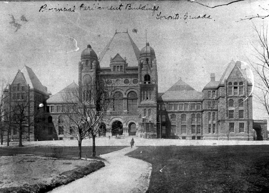


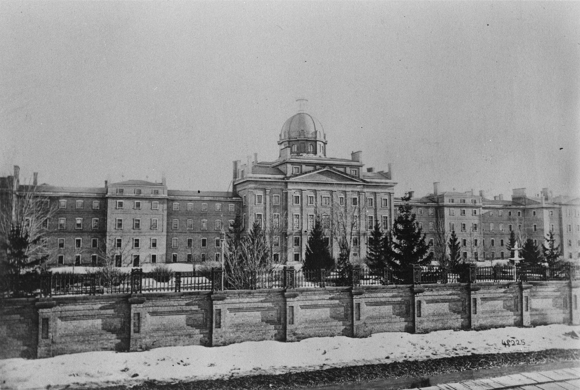


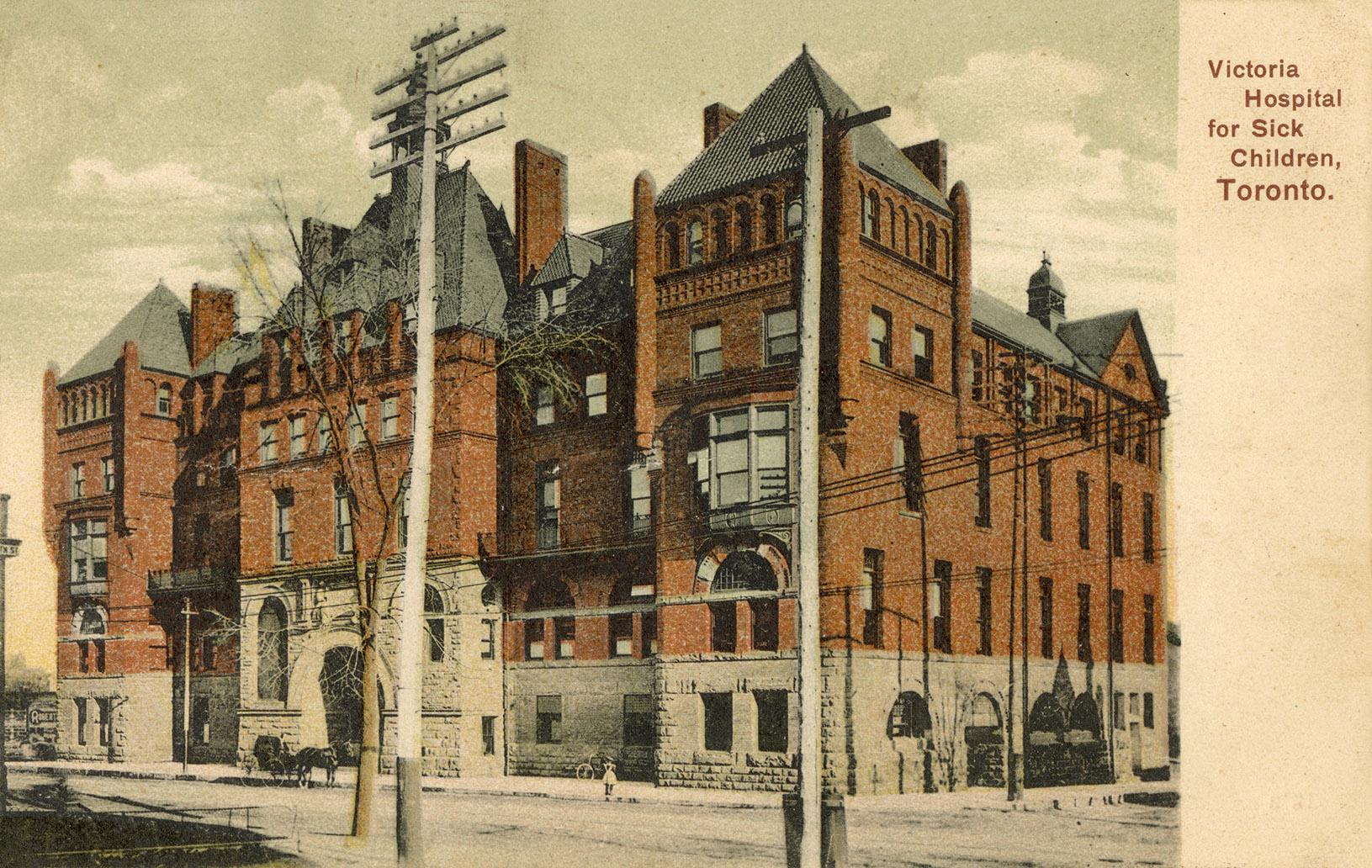


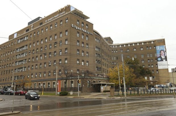
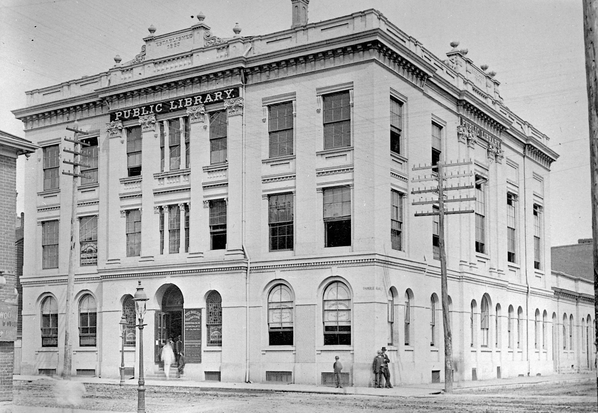


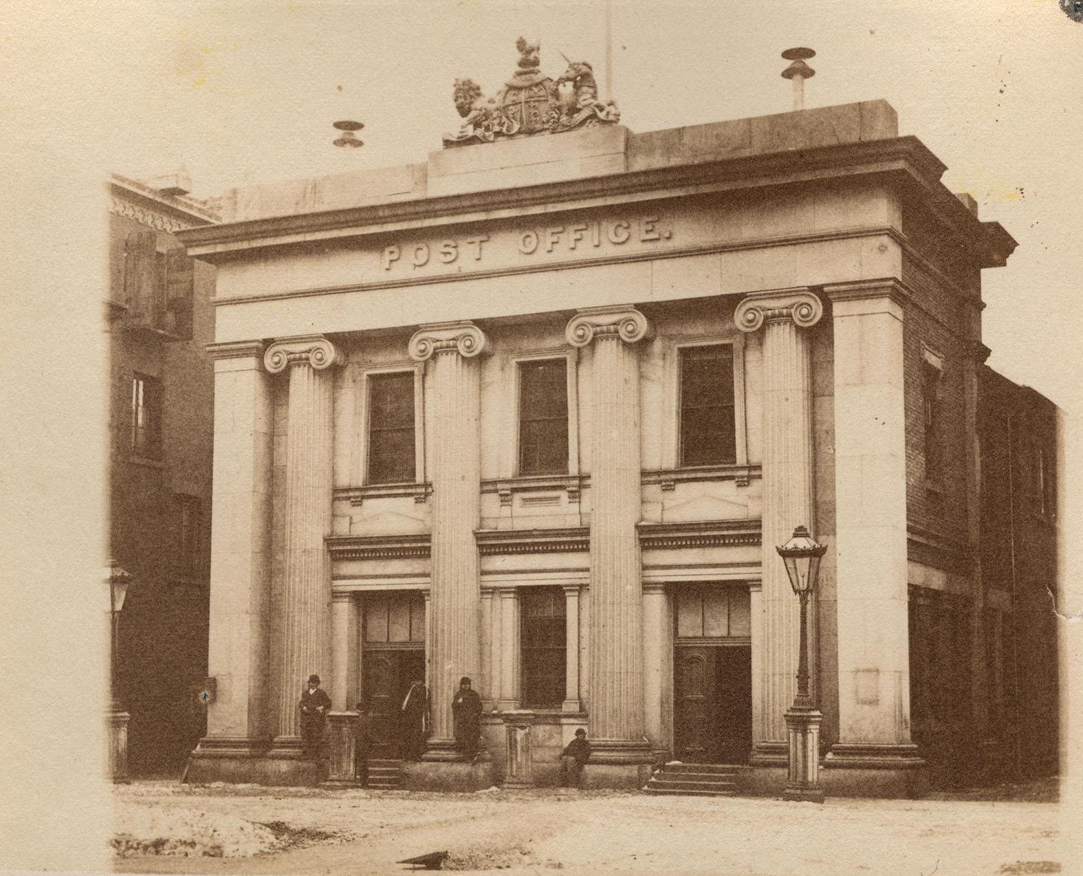
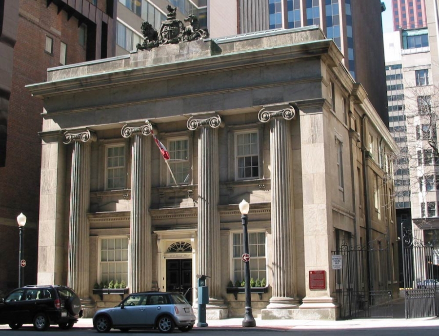


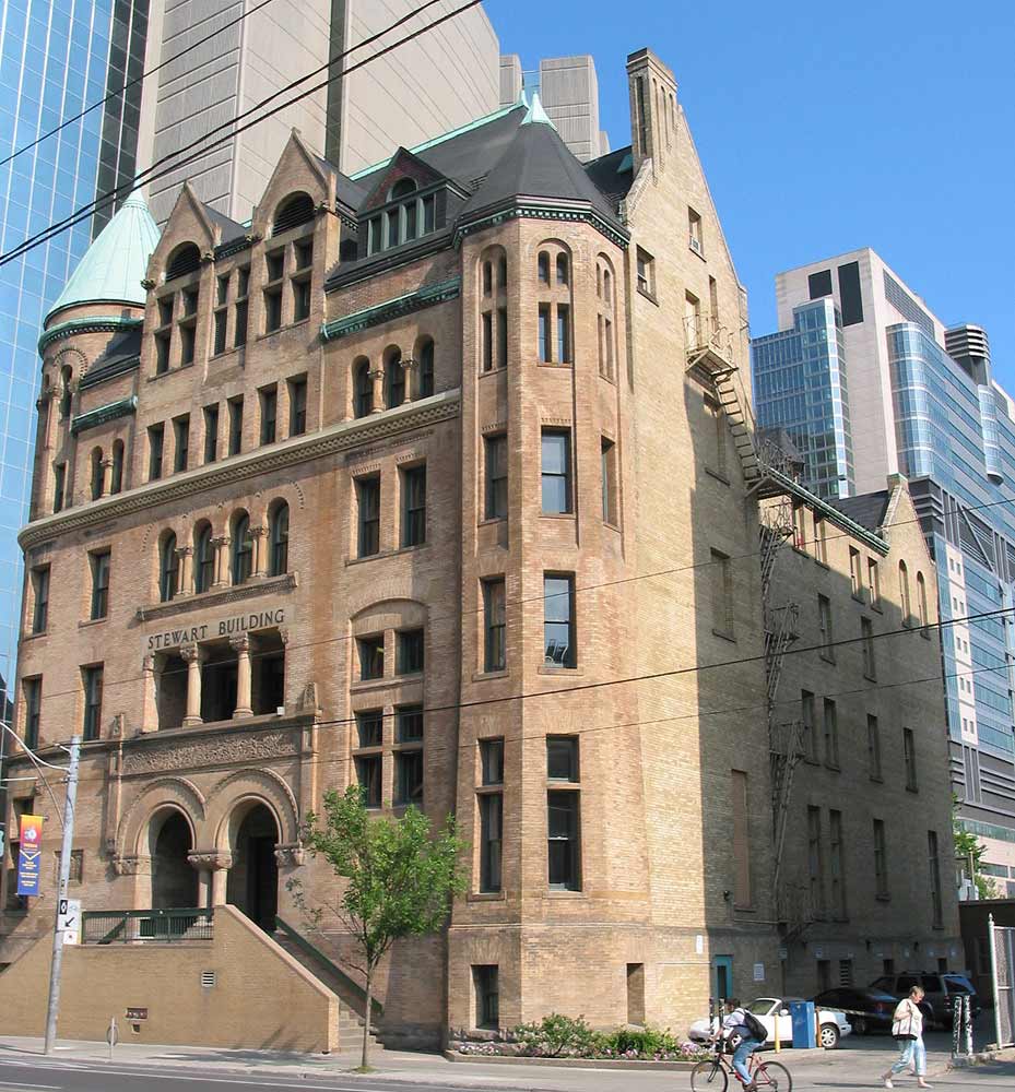


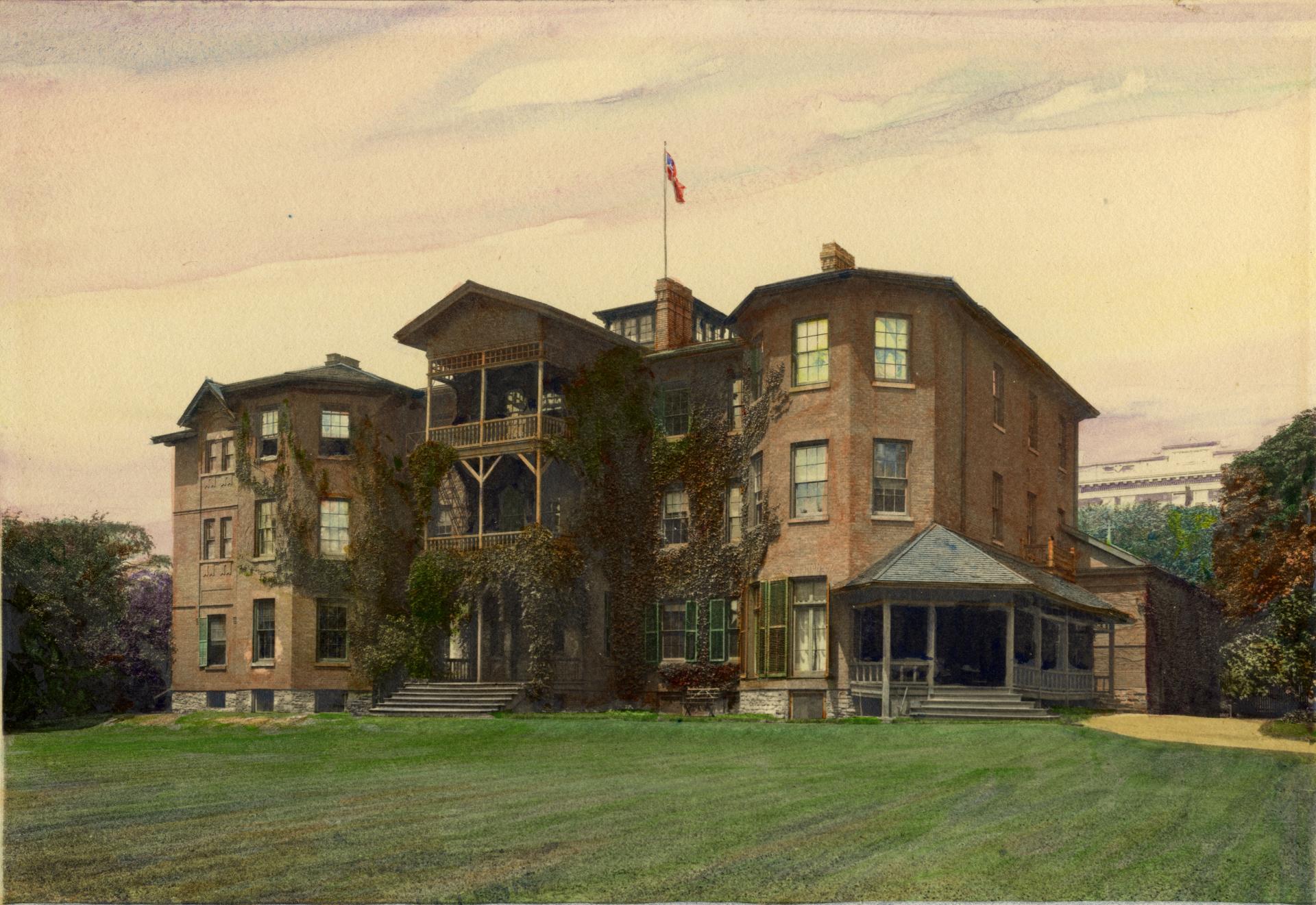


.jpg)
.jpg)
.jpg)


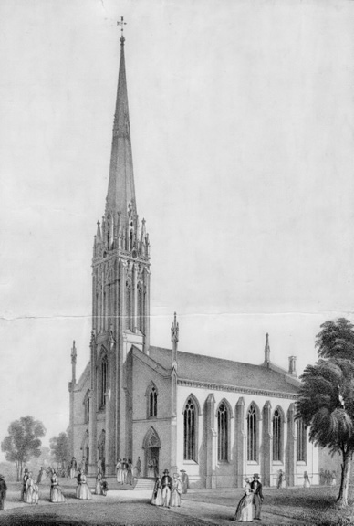


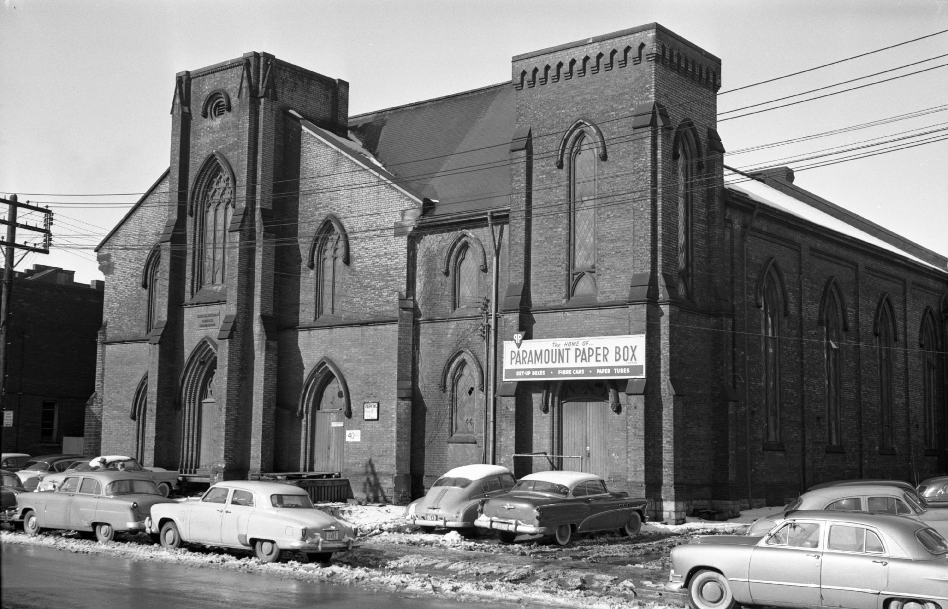
.jpg)

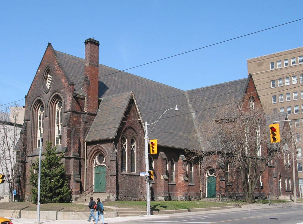


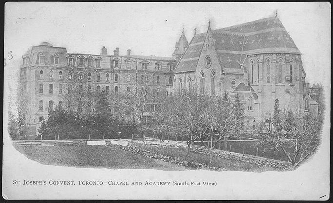


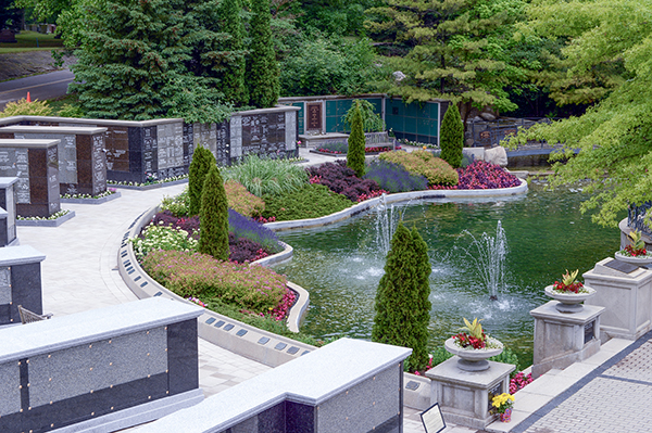


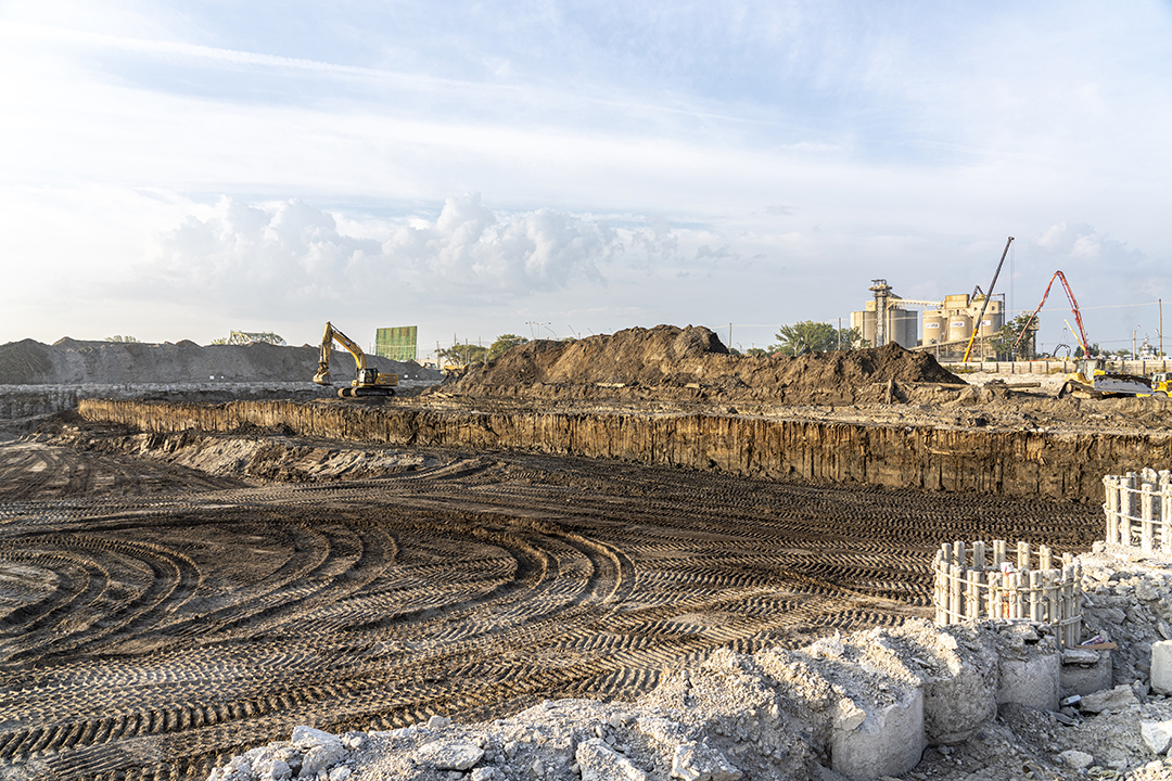

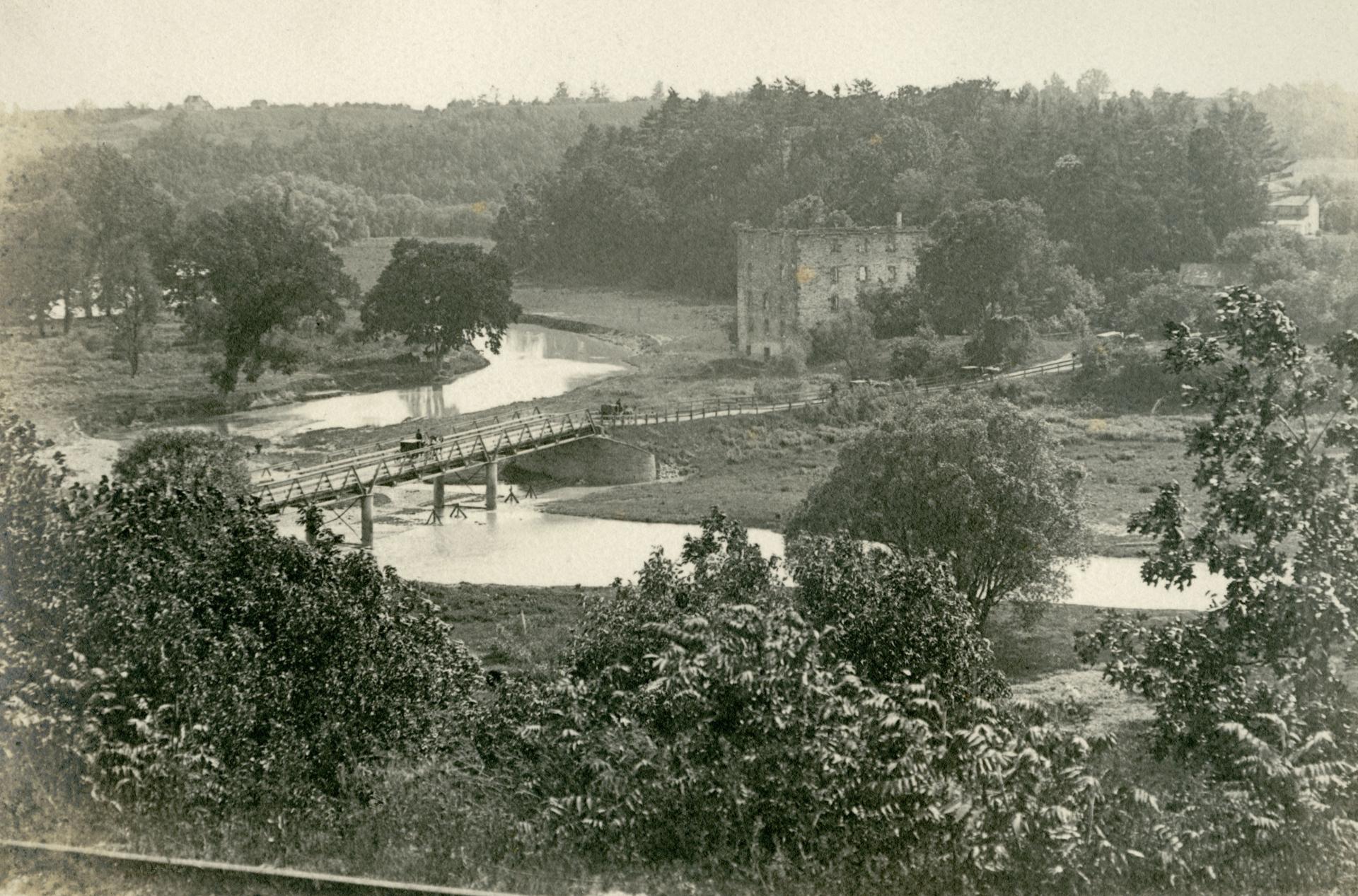


_Allan_Gardens_(3590765579).jpg)

_(17413085171).jpg)


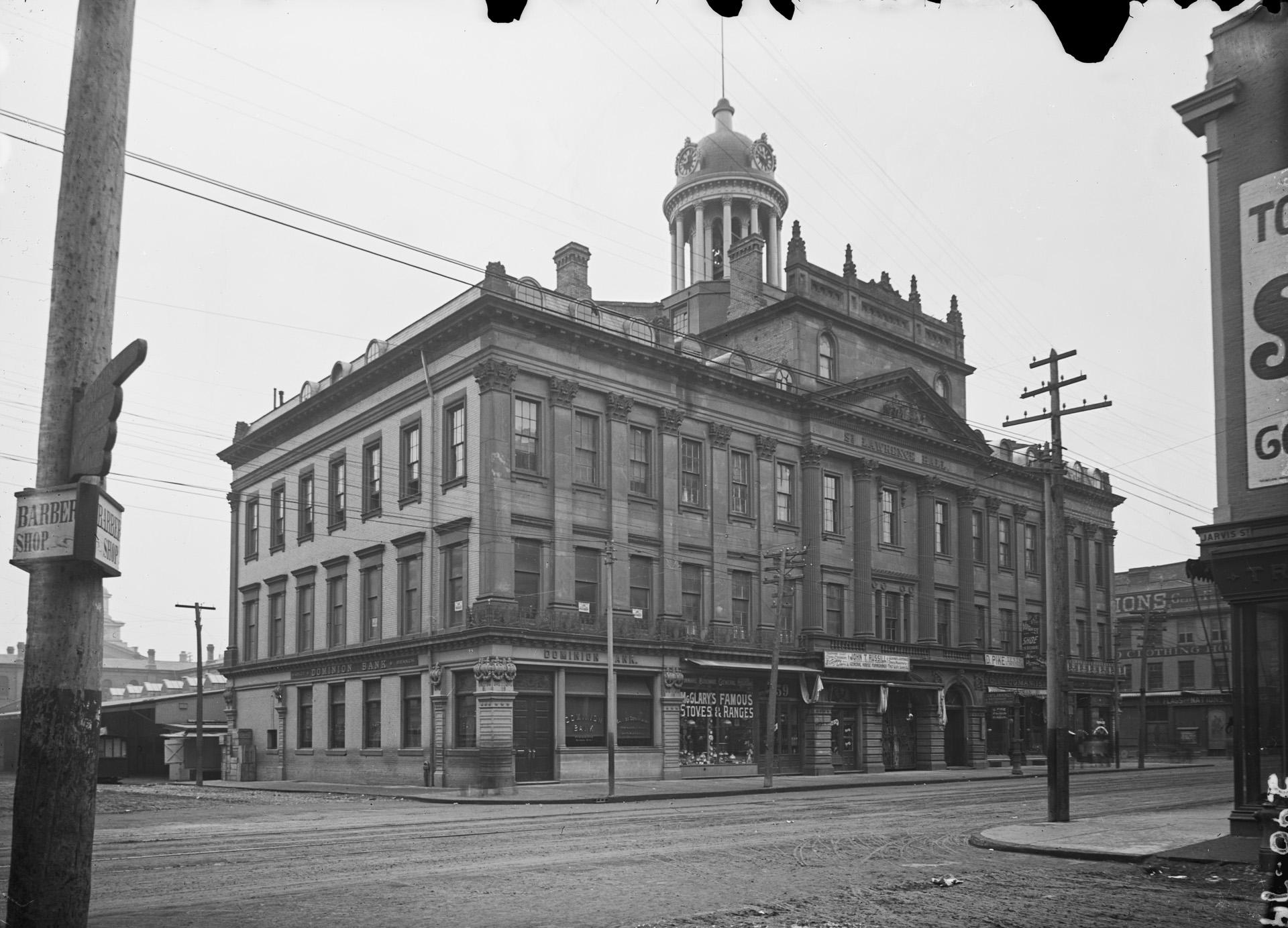
.jpg)

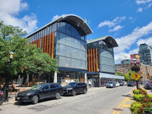


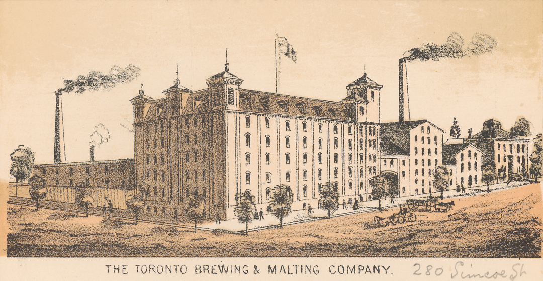


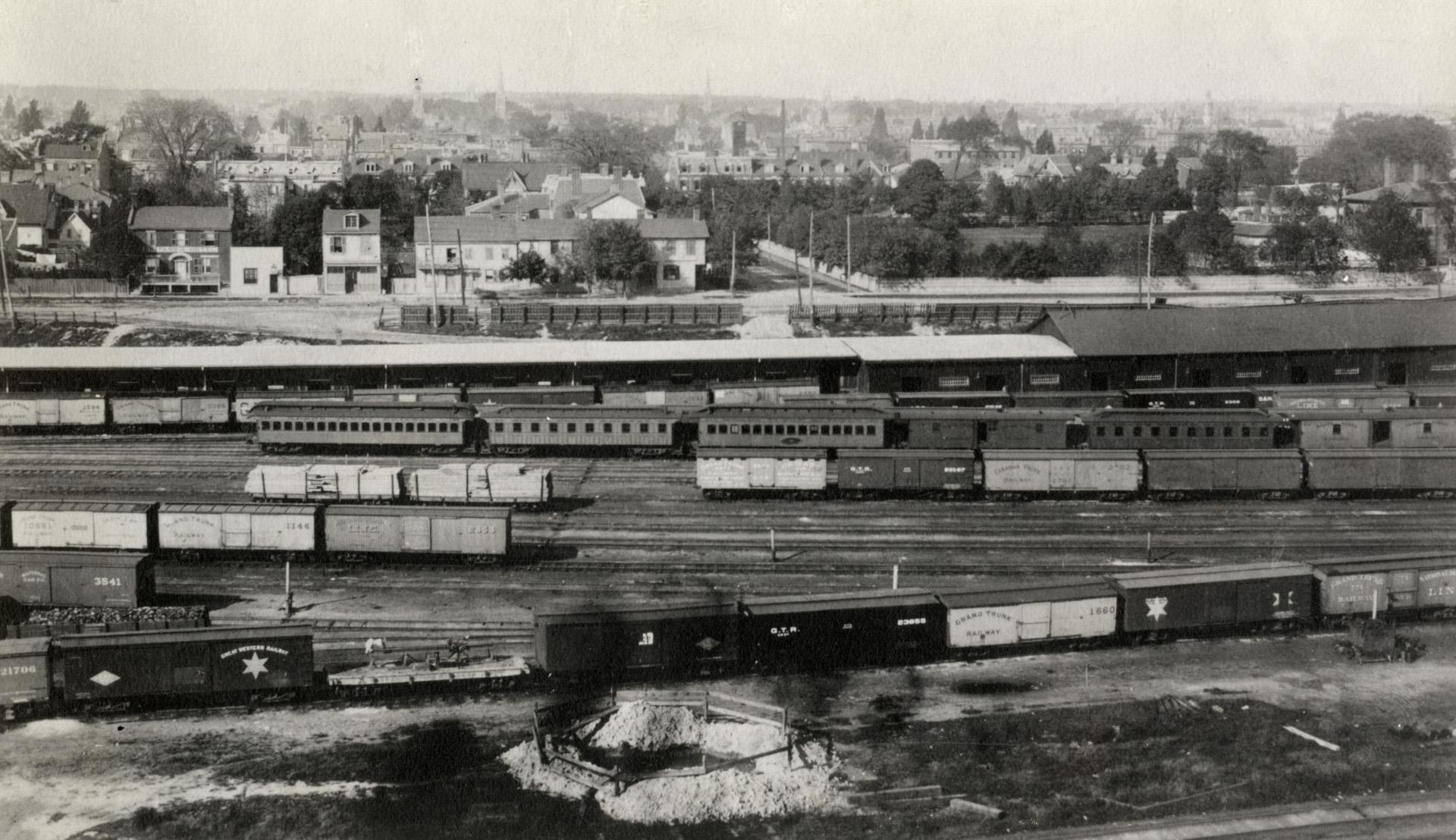


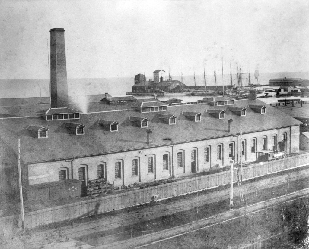


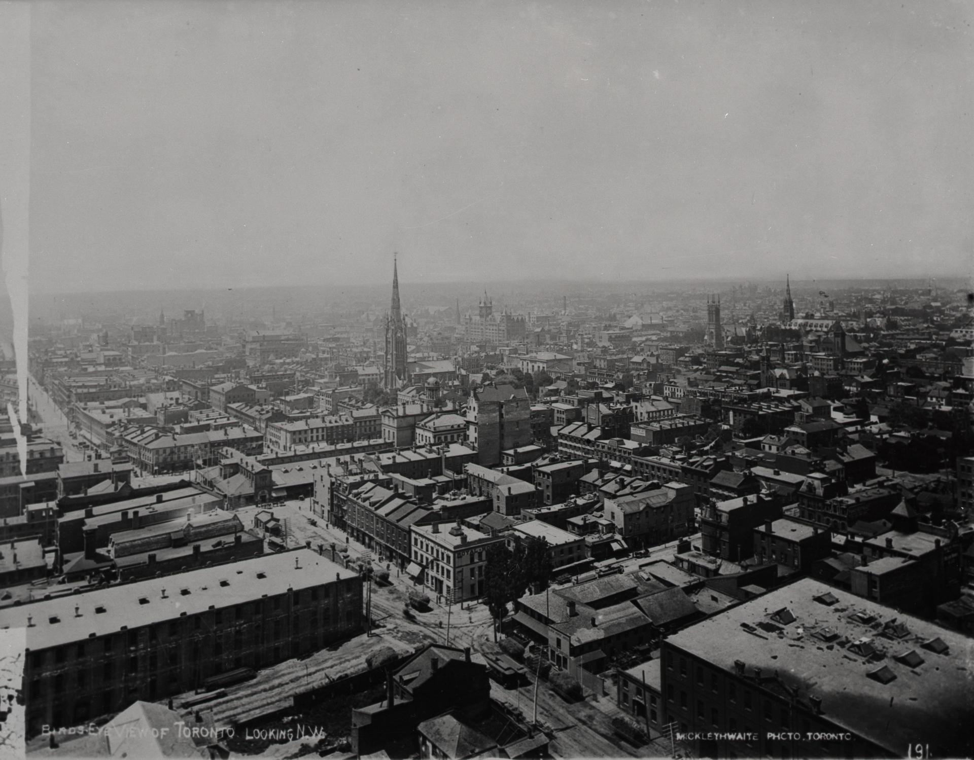
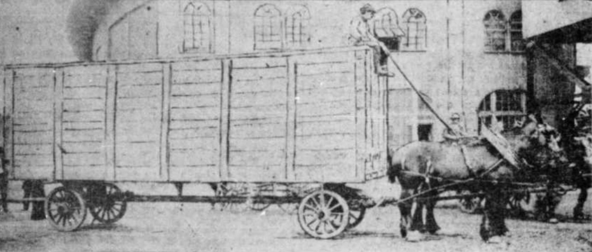

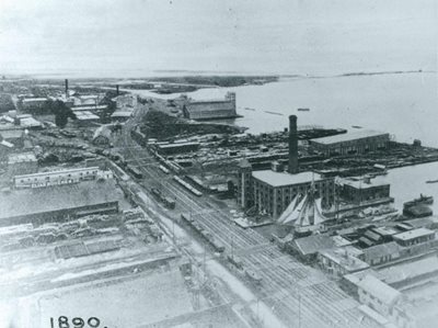


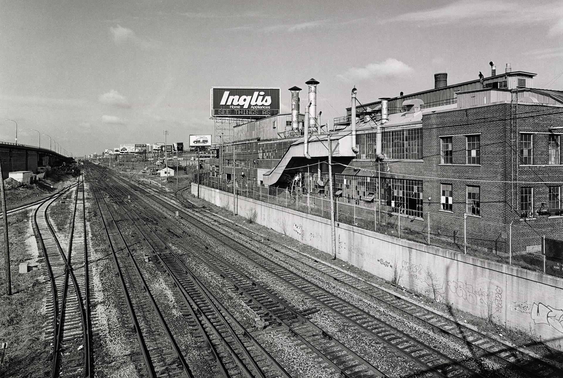
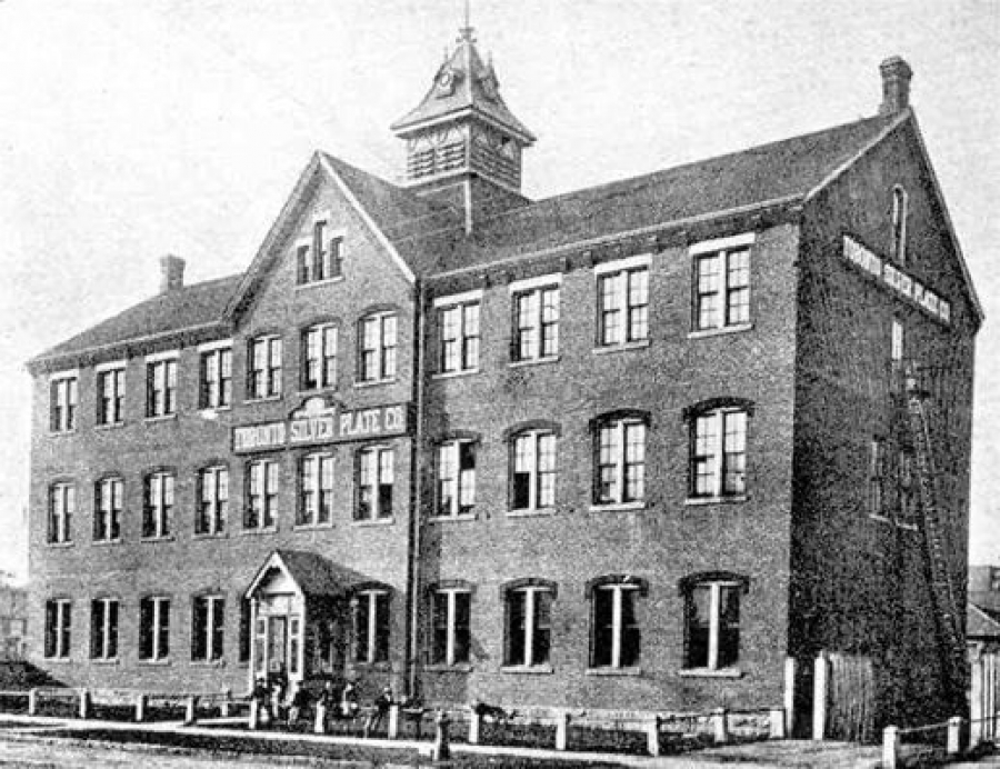


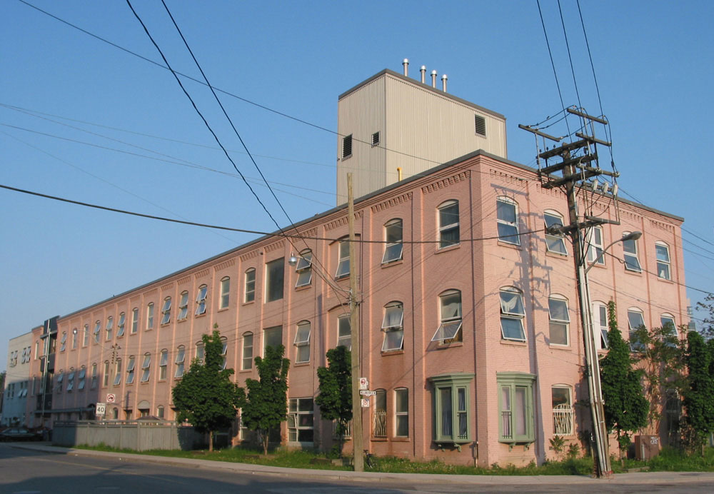


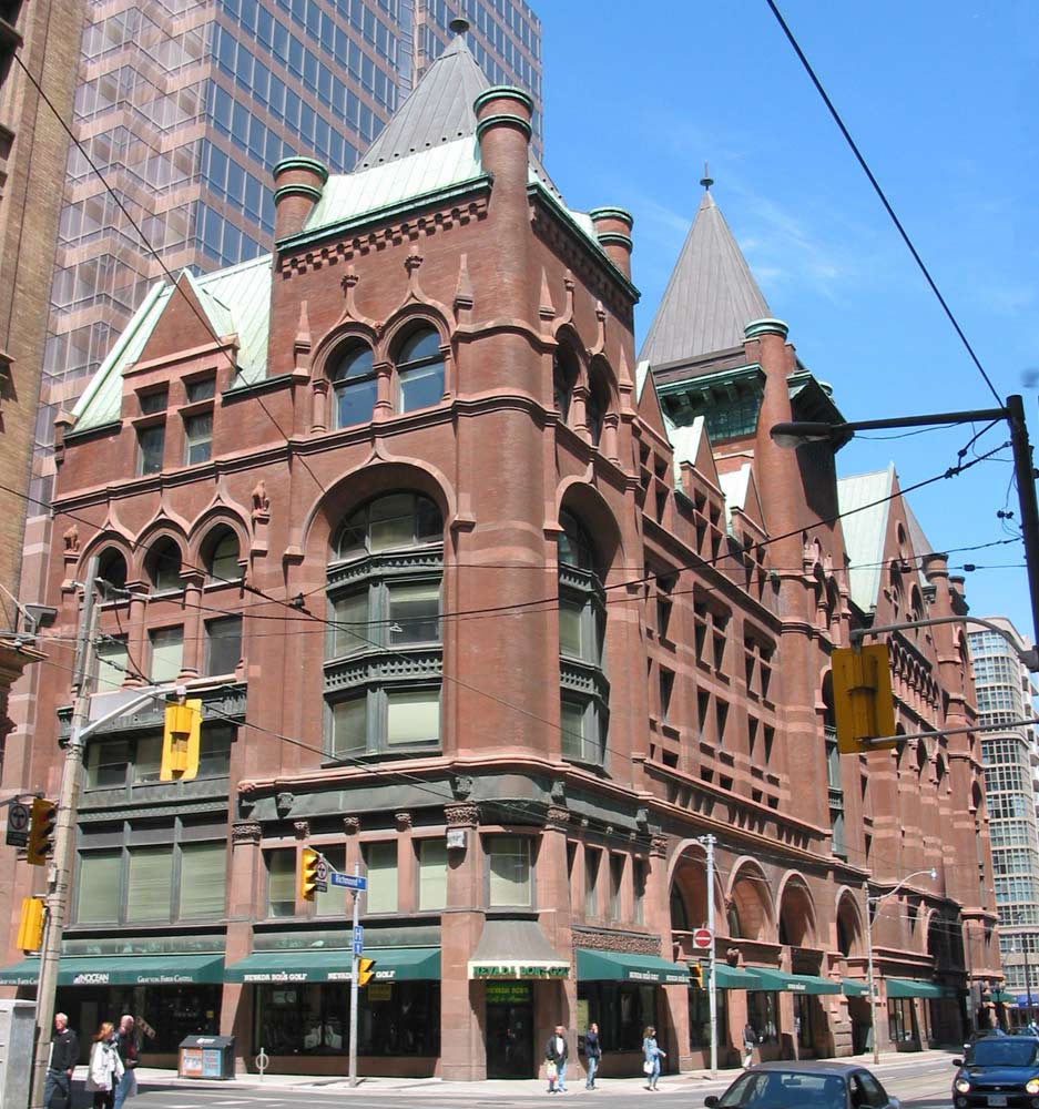


.jpg)


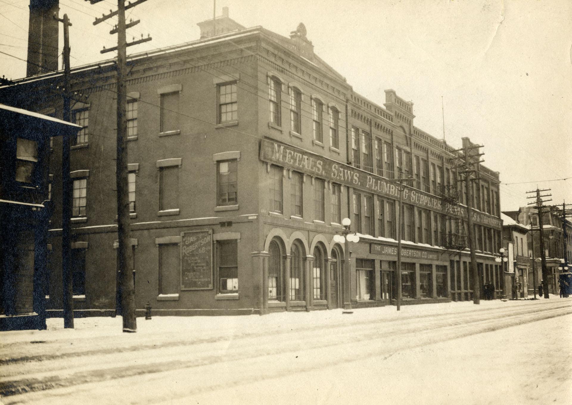
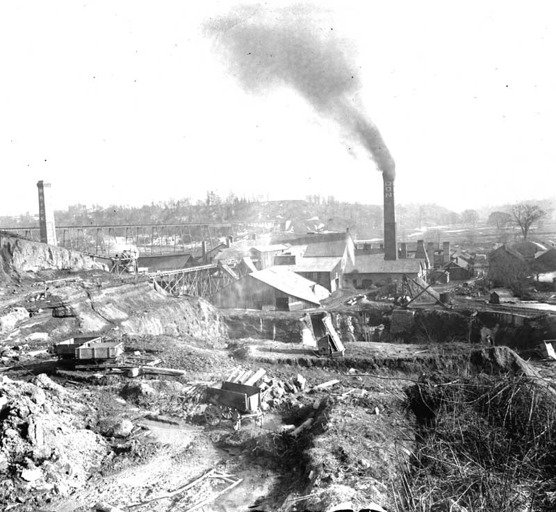


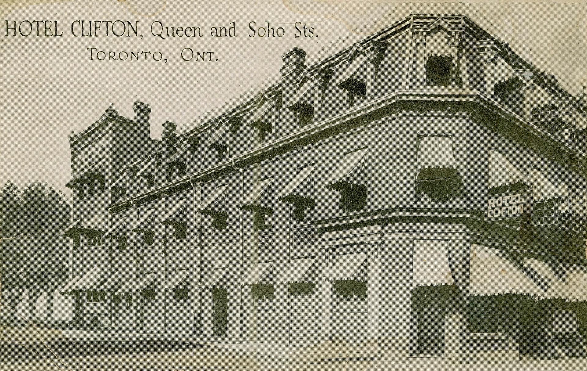


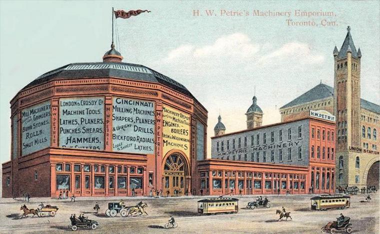

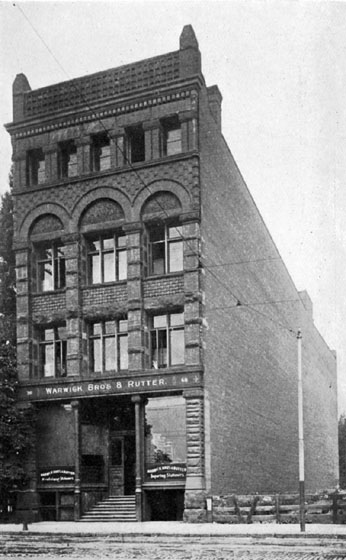
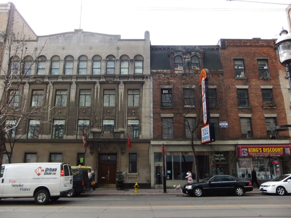


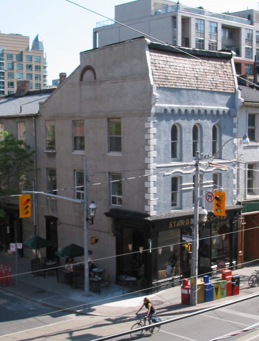

.jpg)

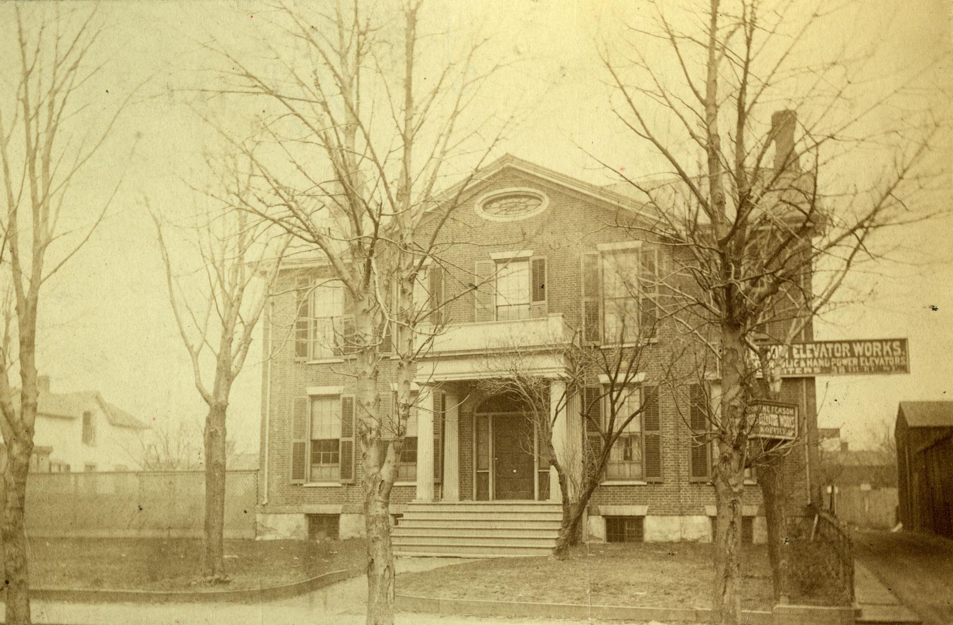
.jpg)
.jpg)